
I am again to tell you about more streets of my eternal Paris. I have many many posts on Paris and several on the streets of the most beautiful city in the world. I have come up with a picture from cd rom vault that should be here for you and me. This allows me to use a post just for it as is one of the street I spent most time in Paris, As always thank you for following my blog some since Nov 26, 2010. Therefore, here is my take on the Rue Saint Antoine of Paris !!! Hope you enjoy it as I.
The Rue Saint-Antoine is in the 4éme arrondissement of Paris. This street has a rich history, being close to the Place de la Bastille. It lies in the heart of the Marais area, of which it is an important thoroughfare, and intersects with streets typical of this area such as Rue Saint-Paul, Rue de Turenne, Rue de Birague (which leads to the Place des Vosges), and Rue Beautreillis. Rue Saint-Antoine (originally Saint-Anthoine) is 603 meters long in the Saint-Gervais and Arsenal quartiers/neighborhoods. It begins at 3 Place de la Bastille and ends at 2 Rue de Sévigné and 16 Rue de Fourcy. It begins at the Place de la Bastille and ends at the Saint-Paul metro station of line 1, near the Place des Combattantes-et-Combattants-du-Sida, where, under the name “Rue de Rivoli,” it continues to the Place de la Concorde. This axis extends beyond the Place de la Bastille, as the Rue du Faubourg-Saint-Antoine. It owes its name to the Abbey of Saint-Antoine, to which it led directly. This street was built on a section of the Roman road that connected Paris to Melun, overlooking the marshy areas. This road began at a junction with the Roman road from Paris to Senlis (present-day Rue Saint-Martin) at the end of the Roman bridge, on the site of the current Pont Notre-Dame. It then passed north of the Port de Grève (present-day Place de l’Hôtel-de-Ville) and the Saint-Gervais hill, continuing along the site of the present-day Rue François-Miron and beyond the Bastille via Rue de Charenton. This ancient Roman route was incorporated in the 10C into the first medieval city wall, exiting through the Porte Baudoyer, located at the corner of Rue du Pont-Louis-Philippe and Rue François-Miron. The route of the Roman road between Rue Saint-Martin and Place Saint-Gervais has disappeared, absorbed by Avenue Victoria, Place de l’Hôtel-de-Ville, and the Hôtel-de-Ville itself. The section corresponding to this road between Place Saint-Gervais and Porte Baudoyer, known until 1865 as Rue du Pourtour Saint-Gervais or Rue du Monceau-Saint-Gervais, was incorporated into the part of Rue Saint-Antoine renamed Rue François-Miron that year. The section of Rue Saint-Antoine between the old Baudoyer Gate of the first medieval city wall and the first Saint-Antoine Gate of the Philippe-Auguste wall (aka the Baudeer Gate), located at the corner of Rue Culture-Sainte-Catherine, now Rue Madame-de-Sévigné, was called “Grande Rue” and “Rue de la Porte-Baudeer,” or “Rue de la Porte-Baudet,” or “Rue de l’Aigle” in the 13C and early 14C, due to a private mansion or inn located near this gate, at the corner of Rue de Jouy. This section corresponds to the current Rue François-Miron.
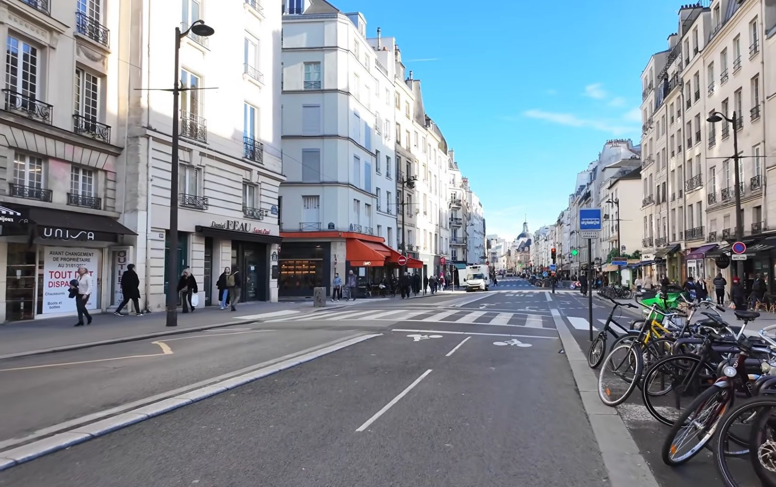
Around the mid-14C, this street was extended beyond the Philippe-Auguste wall to the Saint-Antoine Gate of the Charles V wall, which was built at that time. The section of the street between the two walls was named “rue du Pont-Perrin” because of a stone bridge, “pons petrinus,” which crossed a stream near the rue du Petit-Musc, a stream that later became a sewer. It was in this street, near the first Saint-Antoine gate or bastion of the Philippe-Auguste wall, that Étienne Marcel, provost of the merchants of Paris, was massacred. At the end of the 14C, the Bastille was built at the end of the street near the Charles V wall. In the 15C, the “rue de la porte Baudoyer,” or “rue de l’Aigle,” and the “rue du Pont-Perrin” merged to form the “Grant rue Saint-Antoine” because this thoroughfare led to the Abbey of Saint-Antoine-des-Champs, then located outside Paris. The section between the two former gates was also called the “cours Saint-Antoine” because of its considerable width. In 1636, the Rue Saint-Antoine ended at the Sainte-Catherine Church; it then extended to the rue Geoffroy-l’Asnier. In 1650, it had gained even more ground and now only ended at the rue des Barres. Its encroachments eventually absorbed the entire “rue de la Porte-Baudoyer.” In the 18C, the rue Saint-Antoine was a major venue for the Paris Carnival. In the 19C, the Rue Saint-Antoine, 986 meters long, began at 9, place Baudoyer and 34, rue des Barres and ended at 1, boulevard Beaumarchais and boulevard Bourdon. Odd numbers 1 through 99 were located in the former 7éme arrondissement, Saint-Jean market quartier or neighborhood. Odd numbers 101 through 223 were located in the former 8éme arrondissement, Marais quartier or neighborhood. Even numbers were entirely located in the former 9éme arrondissement, from 2 through 80, Hôtel-de-Ville quartier/neighborhood, and from 82 through 236, Arsenal quartier/neighborhood. The street numbers were black. The last odd number was 223 and the last even number was 236.
Notable buildings here are the fief of Saint-Éloy, a gift from King Dagobert to the Abbey of Saint-Éloi, was located around the now-vanished Church of Saint-Paul-des-Champs and ran along Rue Saint-Antoine around Rue Saint-Paul. Dark paving stones mark the site of a prison tower at no 4. They extend to no 3 on Place de la Bastille. Nos 7 and 9: former low-rise houses typical of the old monarchy or Ancien Régime. At no 10 stands the statue of Beaumarchais , who died at no 20 on the boulevard bearing his name, erected in 1897. No 17: Protestant temple of the Marais, a member of the United Protestant Church of France. Church of Saint Mary under the Ancien Régime, At No. 20 (in the vicinity): site of the “Perrin Bridge,” meaning stone bridge (pons petrinus). It is mentioned as early as 1176. It crossed a covered sewer running alongside Rue Saint-Antoine from the Baudoyer Gate to the Bastille. The sewer was diverted in 1147, following the current route of Rue de Turenne, because it was polluting the lodgings of the Hôtel Saint-Pol and the Hôtel des Tournelles. Part of the street was called “Rue du Pont-Perrin” in the 14-15C. At No. 21: Hôtel de Mayenne or Hôtel du Maine, later known as Hôtel d’Ormesson, built in 1613 for Henri de Lorraine, it was completed in 1617 and then remodeled in 1708-1709. Nos. 28 to 38: site of the first Hôtel des Tournelles.
At No. 40: site of the Grand and Petit Chaumont fiefdoms. While the plot is documented since 1604, the current building, very narrow, dates only from the mid-17C. Nos. 47 to 59: site of the façade of the former Hôtel de Beautreillis, acquired in 1362 by King Charles V, which became part of the royal residence of the Hôtel Saint-Pol. The hôtel particulier was sold in 1554 after the land was divided into lots and the Rue Beautreillis was opened. No trace remains of the buildings from that period. No. 62: Hôtel de Sully and site of the carousel of June 30, 1559, where King Henry II was mortally wounded by the Count of Montgomery in a tournament. No. 70: site of the entrance to the Petit-Sully, outbuildings of the Hôtel de Sully. No. 99: Church of Saint-Paul-Saint-Louis.(see post) No. 101: entrance to the Lycée Charlemagne, which was formerly the site of the Saint-Antoine gate of the Philippe Auguste city wall. No. 111: Hôtel des Vivres (Provisions Hotel). No. 117: 17C house. During the Second Empire, it housed a billiard room where Louise Michel held several political meetings in 1870 and 1871. Closed in 1872, it became a public dance hall until 1912. A furniture warehouse was then established there, before being transformed into a cinema: the Cinéphone Rivoli was inaugurated on July 13, 1938. Renamed Studio Rivoli on March 19, 1948, it was permanently closed on December 31, 1979. Various businesses subsequently occupied the premises. Nos. 119 and 119 bis: entrance to the passage Charlemagne , private road between Rue Saint-Antoine and rue Charlemagne, The Saint-Paul cinemas (2200 then 1300 seats) and Cinéphone-Rivoli (470 seats) then Studio-Rivoli were located at no. 73 and no. 117.
The Paris tourist office on Paris Centre (arrond 1-4) of Paris : https://parisjetaime.com/eng/article/explore-the-centre-of-paris-a846
There you go folks, another dandy beautiful set of glorious streets of my eternal Paris. I have criss cross them many and have many in my blog already, This is an unique historical street that deserves a post of its own, me think, Again, hope you enjoy this post on the Rue Saint Antoine of Paris !!! as I.
And remember happy travels, good health, and many cheers to all !!!


