
 The docks of the port of Commerce welcome the goods arriving in Vannes after crossing the Gulf of Morbihan. At the exit of the Marina, the Parc du Golfe (Gulf Park) is the starting point for passenger boat cruises of the outlying islands, and the Gare Maritime. Many passenger and cargo boat cruisers are here to take you out into the outlaying islands. Popular with locals and visitors alike boaters and tourists thanks to its location in the heart of the city, the Marina is equipped with many facilities: harbormaster cultural kiosk, tourist office, green area and underground parking le Port.
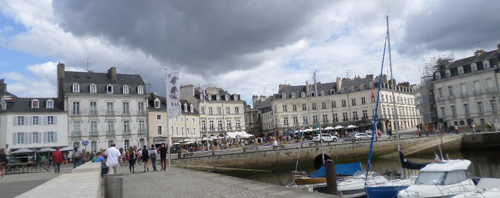
 The place Gambetta, of hemispherical plan, marks the end of the port of Vannes and puts it in contact with the historic center by the Porte Saint-Vincent. The place was created in 1835 in order to clean up a low zone corresponding to the old ditches of the city, in which the sewage accumulated. The Marle river then threw itself into the channel leading to the Gulf of Morbihan, between two mudflats. The construction of the houses of the place du Morbihan(current Pl Gambetta) was completed in 1843. The square was restored in 1976, which gave rise to the destruction of the surviving arches of the old St. Vincent bridge. New road works, in 2005, brought to light a last ark still in condition. The free space is almost entirely used by the terraces of cafes and restaurants. Very nice indeed !!!
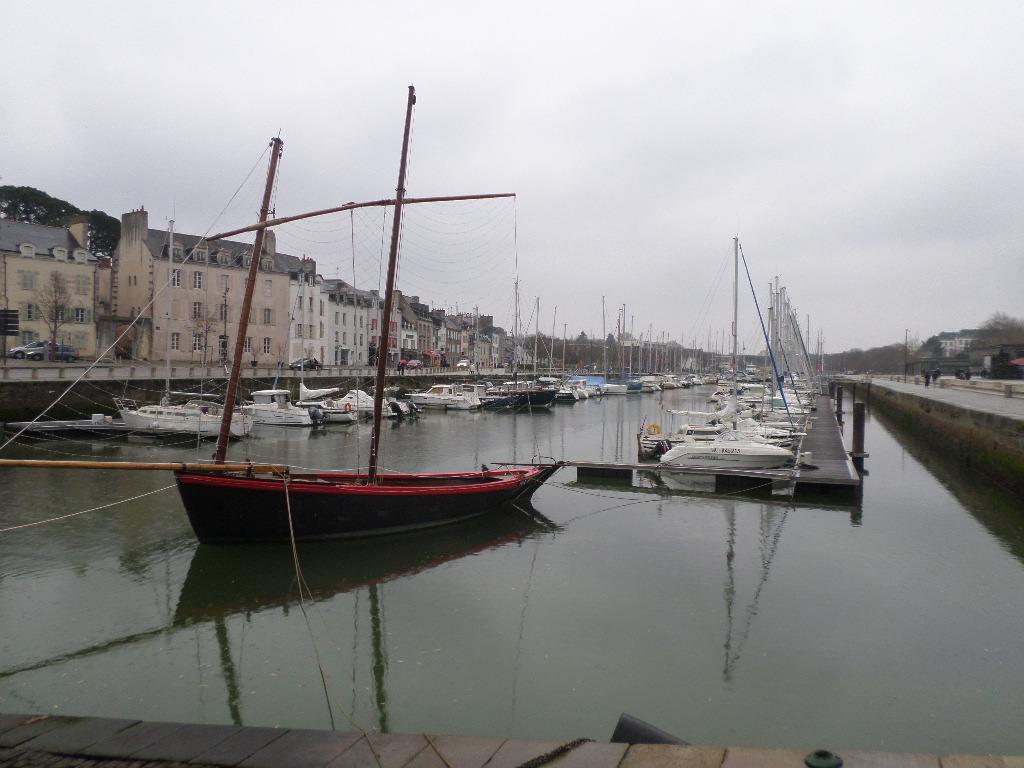
 Located on the right bank of the port, the Promenade de la Rabine walkway is made up of a long alley of trees stretching about 800 meters between the Esplanade of the Port to the north and the docks of the commercial port to the south. The construction of a wharf and the destruction of the Saint-Julien chapel in 1740 allowed the widening of the rows of trees in front of the convent of Carmelites barefooted in 1745. As the docks expanded southwards, the Promenade de la Rabine was extended. In 1887, the extension of the promenade beyond the Santière, to the Pont-Vert.
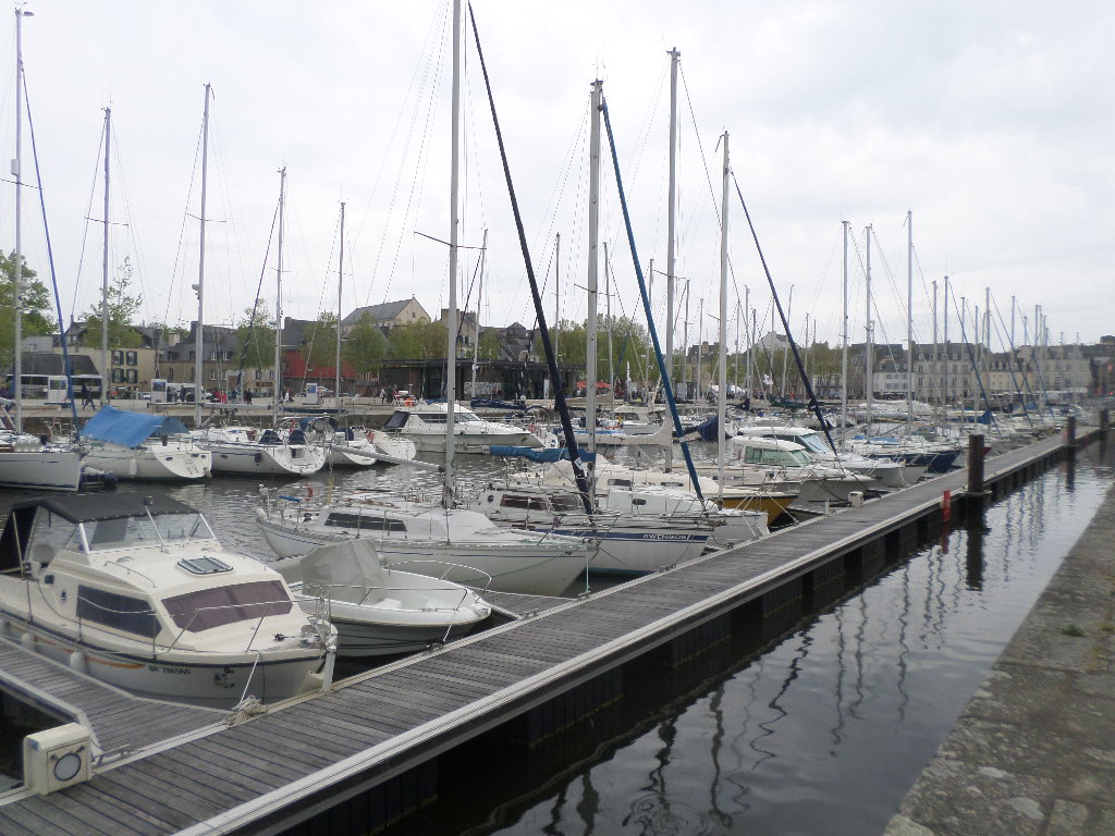 The Marina has a capacity to host 280 boats on pontoons. It can accommodate 34 boats on dead body. The port of Vannes has a visitor area for your stopovers with 60 places available. Popular with locals and visitors alike boaters and tourists thanks to its location in the heart of the city, the Marina is equipped with many facilities: harbormaster cultural kiosk, tourist office, green area and underground parking le Port.
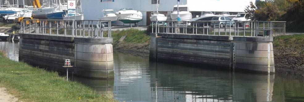
 A bit of history I like tell us the first traces of the existence of a port in Vannes date back to the Roman occupation of the city of Vénètes (celtic tribe) then known as Darioritum. The research carried out on Darioritum shows that the port was the heart of the urban and commercial growth of the 1C to 5C .Until the end of the 14C, no document known to date allows to specify the actual configuration of the port. From 1604, a new wharf is built on the right bank. The Porte Saint-Vincent and the double-antenna bridge which served it are completed around 1625 facilitating the passage from one side to the other south of the ramparts. At the time of the exile of the Parliament of Brittany in Vannes ,1675-1689, a hunting lock is fitted upstream of the Porte de Calmont to clean the moat of the garbage and wastes that accumulate there and weaken the current of the river. A second lock, known as Kérino, is mentioned in 1683, much further downstream.
In 1697, the left bank of the port saw the realization of its first wharf, the pier Billy, the name of its owner. In 1754, recurrent problems of pollution and siltation forced the city to incur considerable costs for the construction of a new hunting lock in front of the Saint-Vincent bridge, and the development of new docks to the south in order to facilitate the docking of boats. At the end of the 18C, king Louis XVI wanted to take out the cities of the middle ages, the reorganization of the space by the filling of ditches. This project is accompanied by the desire to build a place in the form of a hemicycle. It is only in 1835 that the place Gambetta (old place du Morbihan) is carried out, The project of requalification of the left bank between 1995 and 2001 is continued by the operation of raving and restoration of 45 facades located around place Gambetta, rue du port and Rue du Drézen. Finally, in 2003 , in order to give a more important place to pedestrians and to create new service establishments it was done the landscaping of the spaces: realization of a parking under the paved esplanade of granite and the driveway of wood decking, construction of the new harbormaster , the cultural kiosk and the Tourist office. The current look of the port of Vannes and its neighborhood dates from the end of 2000. The second phase of the project which was started in 2011 took care of the the upstream of the port of the Marina, such as the development of the commercial port and the maritime station on the right bank, the future of the buildings of the departmental Directorate of Territories and the Sea (ex DDE ) on the left bank and the construction of the Kerino tunnel at the port entrance.
The official port of Vannes: https://port-de-vannes.com/fiche-pratique-de-votre-port/
The city of Vannes on the Port and pl Gambetta: https://www.mairie-vannes.fr/le-port-et-la-place-gambetta
The Gulf of Morbihan Tourist Office on Le port of Vannes: https://www.golfedumorbihan.co.uk/fiche/port-de-vannes-en/
The tides of the Gulf of Morbihan on Vannes : http://maree.info/107
There you go folks, something nice around boats, history, architecture, the sea what else do you want ! I am always around here just sublime ! Hope you enjoy this post on Le Port of Vannes, part IV as I.
And remember, happy travels, good health, and many cheers to all !!!
A bit of history I like tell us the first traces of the existence of a port in Vannes date back to the Roman occupation of the city of Vénètes (celtic tribe) then known as Darioritum. The research carried out on Darioritum shows that the port was the heart of the urban and commercial growth of the 1C to 5C .Until the end of the 14C, no document known to date allows to specify the actual configuration of the port. From 1604, a new wharf is built on the right bank. The Porte Saint-Vincent and the double-antenna bridge which served it are completed around 1625 facilitating the passage from one side to the other south of the ramparts. At the time of the exile of the Parliament of Brittany in Vannes ,1675-1689, a hunting lock is fitted upstream of the Porte de Calmont to clean the moat of the garbage and wastes that accumulate there and weaken the current of the river. A second lock, known as Kérino, is mentioned in 1683, much further downstream.
In 1697, the left bank of the port saw the realization of its first wharf, the pier Billy, the name of its owner. In 1754, recurrent problems of pollution and siltation forced the city to incur considerable costs for the construction of a new hunting lock in front of the Saint-Vincent bridge, and the development of new docks to the south in order to facilitate the docking of boats. At the end of the 18C, king Louis XVI wanted to take out the cities of the middle ages, the reorganization of the space by the filling of ditches. This project is accompanied by the desire to build a place in the form of a hemicycle. It is only in 1835 that the place Gambetta (old place du Morbihan) is carried out, The project of requalification of the left bank between 1995 and 2001 is continued by the operation of raving and restoration of 45 facades located around place Gambetta, rue du port and Rue du Drézen. Finally, in 2003 , in order to give a more important place to pedestrians and to create new service establishments it was done the landscaping of the spaces: realization of a parking under the paved esplanade of granite and the driveway of wood decking, construction of the new harbormaster , the cultural kiosk and the Tourist office. The current look of the port of Vannes and its neighborhood dates from the end of 2000. The second phase of the project which was started in 2011 took care of the the upstream of the port of the Marina, such as the development of the commercial port and the maritime station on the right bank, the future of the buildings of the departmental Directorate of Territories and the Sea (ex DDE ) on the left bank and the construction of the Kerino tunnel at the port entrance.
The official port of Vannes: https://port-de-vannes.com/fiche-pratique-de-votre-port/
The city of Vannes on the Port and pl Gambetta: https://www.mairie-vannes.fr/le-port-et-la-place-gambetta
The Gulf of Morbihan Tourist Office on Le port of Vannes: https://www.golfedumorbihan.co.uk/fiche/port-de-vannes-en/
The tides of the Gulf of Morbihan on Vannes : http://maree.info/107
There you go folks, something nice around boats, history, architecture, the sea what else do you want ! I am always around here just sublime ! Hope you enjoy this post on Le Port of Vannes, part IV as I.
And remember, happy travels, good health, and many cheers to all !!!
