
I am again to tell you about more streets of my eternal Paris. I have many many posts on Paris and several on the streets of the most beautiful city in the world. I have come up with pictures from cd rom vault that should be here for you and me. As always thank you for following my blog some since Nov 26, 2010. Therefore, here is my take on the streets of Paris, part XXXII !!! Hope you enjoy it as I.
The Rue Galande is located in the Saint-Michel and Sorbonne quartier or neighborhoods, of the 5éme district or arrondissement of Paris. This nearly 200-meter-long street retains a medieval appearance today with its curved layout, narrow sidewalks, cobblestone lane, and sometimes very old buildings. Rue Galande is accessible by metro line 10 at the nearby Maubert-Mutualité station. The origin of its name refers to the old Garlande enclosure, which it ran alongside, owned by the family of Étienne de Garlande, a favorite of King Louis VI the Fat, who owned a vineyard there. In Gallo-Roman times, the street was on the route of the road linking Lutetia to Fontainebleau. It was actually opened in 1202 on the site of the so-called Garlande enclosure, a fiefdom divided up in 1127 after the disgrace of the Garlande family, and it became very commercial. In the 14C, almost the entire street belonged to the Chapter of Notre-Dame de Paris. Until the end of the 19C, this street began at Place Maubert and Rue des Lavandières-Place-Maubert and ended at Rue Saint-Jacques and Rue du Petit-Pont. The street numbers were black. The last odd number was 79 and the last even number was 60. It was located in the former 12éme arrondissement, then in the 5éme arrondissement after the latter’s creation in 1859. The street was 230 m long as compared to 165 meters today. The section of the street towards Place Maubert was in fact removed by the opening of Rue Lagrange. Today, there are still a few half-timbered houses and remnants of the Saint-Blaise chapel, which was the headquarters of the brotherhood of carpenters and masons. Notable buildings here are at Nos. 29, 31, 33, 35, 37: medieval houses dating from the 15-16C, No. 41: site, between 1198 and 1270, of a Jewish cemetery. In the 13C, the Jewish community had two cemeteries on the Left Bank: this one and Rue Pierre-Sarrazin. In 1270, Philip III the Bold prescribed that the Jews would have only one cemetery in Paris. They had to abandon the one at No. 42 Rue Galande, The Studio Galande, an art-house cinema known for showing The Rocky Horror Picture Show since its release in 1975. On the facade, on the left side, a carved stone panel embedded in the wall represents an episode from the life of Saint Julian the Poor; this bas-relief, already mentioned in 1380, This bas-relief comes from the Church of Saint-Julien-le-Pauvre. Following the work carried out in the church in the 17C, it was stored in the chapel at no. 48. After its destruction, it was installed on the facade of the building (see photo) At No. 48: building on the top floor of which the painter Pierre Soulages lived and set up his studio from 1957 to 1973. On this site was the old chapel of Saint-Blaise-Saint-Louis, built around 1200 and demolished in 1770. No. 57: site of the cabaret Le Château Rouge (colloquially called La Guillotine). This disreputable establishment, described by Joris-Karl Huysmans, French writer and art critic, in La Bièvre et Saint-Séverin (chapter VII), was a stop on the “tour of the grand dukes”.
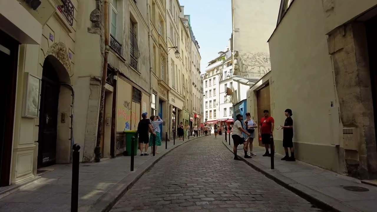
The Rue de la Harpe is located in the Sorbonne quartier or neighborhood of the 5éme district or arrondissement of Paris. It takes this name, which its northern part already bore in 1247, from a sign that hung from the second house on the right above the Rue de Mâcon. The Rue de la Harpe started from the Place du Pont-Saint-Michel under the name of “la Vieille-Boucherie”, renamed Rue de la Harpe from the 13C, the name coming from a sign. The part between the Rue de la Huchette and the Rue Saint-Séverin corresponds to the Rue de La Vieille Bouclerie or Rue de la Vieille Boucherie. Around 1280-1300 it is cited in the form “rue de la petite Bouclerie”, for the current northern part of the street between the rue de la Huchette and the rue Saint-Séverin and “rue de la grant Bouclerie” for the part which went from the rue Saint-André-des-Arts to the rue de la Petite Bouclerie but which disappeared when the boulevard Saint-Michel was built. The northern part of the old rue de La Harpe was also called “rue la Juiverie” and “rue aux Juifs” because the Jews had their schools there. From Rue de l’École-de-Médecine to the former Place Saint-Michel, now Place Edmond-Rostand, it was called “Rue Saint-Côme” because of the church of that name, and “Rue aux Hoirs d’Harcourt” because the Collège d’Harcourt, founded in 1280) was located there. In 1636, “Rue de la Harpe” and “Rue Saint-Côme” were distinguished. In the mid-17C, its entire length was called Rue de la Harpe. It has had several names since the 13C. Formerly, this street led to the gardens of the Palais des Thermes of the Hôtel de Cluny through a carriage entrance. In the first part of the 19C, the rue de la Harpe began at rue Saint-Séverin and rue de Mâcon and ended at the current place Edmond-Rostand and rue Saint-Hyacinthe-Saint-Michel and was located in the former 11éme arrondissement of Paris. The street numbers were black. The last even number was 110 and the last odd number was 129. It was one of the most important streets on the left bank. This street was one of the theaters of the insurrection of the June Days of 1848. A prefectural decree of May 10, 1851, attached the rue de la Vielle-Boucherie, which began at rue de la Huchette and rue Saint-André-des-Arts, to the rue de la Harpe. The section between Rue Saint-Séverin and Boulevard Saint-Germain is the only remaining section of the old Rue de la Harpe. The section up to the current Place Edmond-Rostand was swallowed up by the opening of Boulevard Saint-Michel under the Second Empire (Napoléon III) . Notable buildings here are at Nos. 1 and 2: overlooking Rue de la Huchette. No. 6: the poet Paul Verlaine stayed in a small hotel that stood on this site and met the actor Bibi-la-Purée there. No. 24: Hostater Center of the University of Paris. No. 53: location, in 1947, of an African restaurant run by the former Folies Bergère dancer Féral Benga, in which the first cabaret-theater La Rose Rouge was established that same year. The second cabaret of this name opened the following year at 67 rue de Rennes.
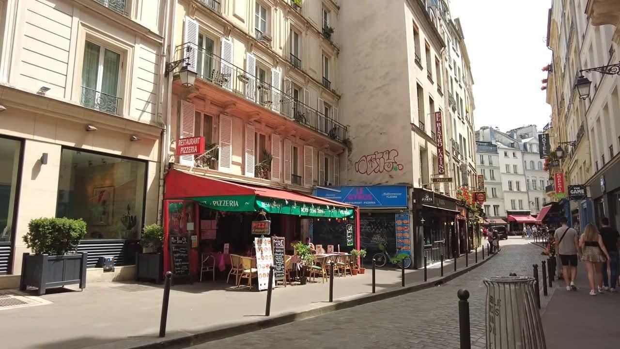
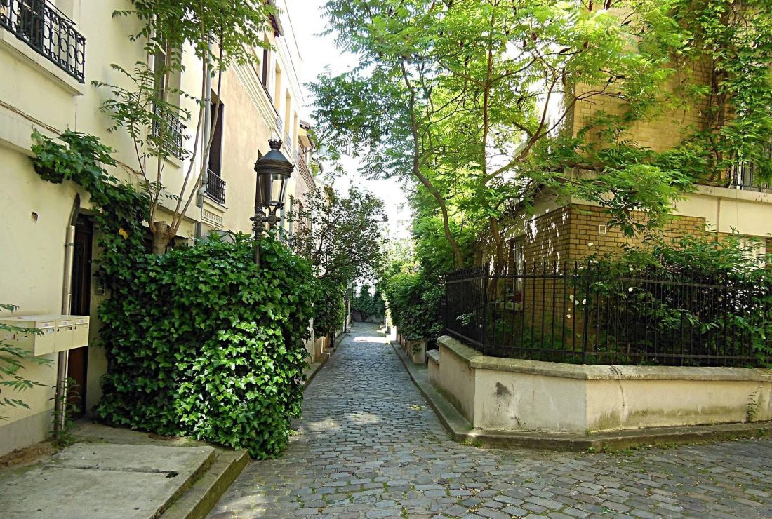
The Square des Peupliers is a triangular-shaped private road in the 13éme arrondissement of Paris on the southern slope of the Butte-aux-Cailles. It begins at 72, rue du Moulin-des-Prés; after a few meters, it divides into two sections, one heading west, the other southwest. Its name comes from its proximity to the rue des Peupliers. The road was opened in 1926 and opened to public traffic on June 23, 1959. The Square des Peupliers is lined with townhouses and small buildings. Paved, the road is pedestrianized and the gardens of the various pavilions are abundantly planted, giving this road a particular rural atmosphere. In reference to the above you have the rue des Peupliers is located in the Maison-Blanche quartier or neighborhood. It is located near the Tolbiac and Maison Blanche metro stations on line 7 and is close to the T3a tram line. It is so named because it was originally lined with poplar trees. Formerly the “Chemin des Peupliers” in the village of Gentilly, which existed in 1730, the road was annexed by the City of Paris in 1863, which decided to open the northern section between Rue du Moulin-des-Prés and a branch of the Bièvre. Notable buildings: The street, after passing Place de l’Abbé-Georges-Hénocque, leads to the Postern des Peupliers, where the last surviving gate of the Thiers city wall is located. It runs alongside the former Red Cross Hospital, which became the private Peupliers Hospital in 2006. It passes under the Petite Ceinture line, opened to the public in 2016 in this section at the site of the Poterne-des-Peupliers garden. The Petite Ceinture bridge hosted, exactly in the axis of the street, one of the contemporary works of art installed in 2006 by the city of Paris on the route of the T3a tram line: Mirage by Bertrand Lavier.
The Paris tourist office on the 13éme arrondissement de Paris: https://parisjetaime.com/eng/article/a-walk-through-the%20villages-of-the-13th-arrondissement-a775
There you go folks, another dandy beautiful set of glorious streets of my eternal Paris. I have criss cross them many and have many in my blog already, Again, hope you enjoy this post on the streets of Paris, part XXXII !!! as I.
And remember happy travels, good health, and many cheers to all !!!


🤗😎😍🙌🏼❤️
LikeLiked by 1 person
Thanks for stopping by. Cheers
LikeLiked by 1 person