
I went out today to see some of the coastal towns of my beautiful Morbihan and lovely region of Bretagne. We have come here before but as usual is this land of gems, time is not enough. So we had time and came back for a bit more of its beach ambiance and great food lovely views and discoveries. This is Guidel plage or Guidel Beach but as always here there is also a Guidel simple , the bourg or administrative part. Guidel is located in the coastal area bordering the Atlantic ocean, limited to the west by the Laïta river which marks the border with the Finistère dept 29. Therefore, let me tell you about curiosities of Guidel Plage III !!! Hope you enjoy the post as I
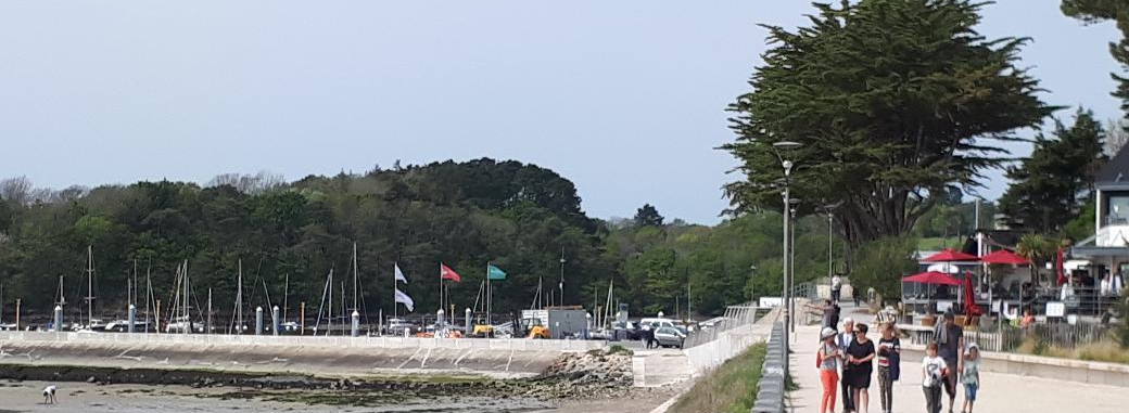
A seaside resort of the coast of megaliths, its coastline has several sandy beaches. Which are big soft sand and great! It is currently included in the area of Lorient, and is part of Lorient agglomeration. With an area of 52.29 km2, it ranks among the largest town of the Morbihan. The town of Guidel, (the bourg) is the most important settlement. It occupies a central position within the towns limits. To the south, at the mouth of the Laita river, a large secondary settlement was developed, Guidel-Plage. To the north, the village of Locmaria, constitutes a secondary agglomeration. The town of Guidel is located at about 10 km west of Lorient and 10 km south of Quimperlé. It is about 40 km (25 mi) from my house!
The beaches of Guidel, because of their exposure to the prevailing winds, are a surf spot. They are among the ten Breton sites most favorable to the practice of this sport. To the south-east of the town, extends an area of ponds such as the ponds of Petit Loc’h and Grand Loc’h, and submersible meadows, marshes, fed by the small coastal river Saudraye and its tributary the Saut du Renard, which form a nature reserve. All beautiful!! The beach is IT here, and oh so nice, in good weather they can compete with any anywhere and I have been to some. This are wide extensive sandy, protected bay, and pretty sand dunes all around you.
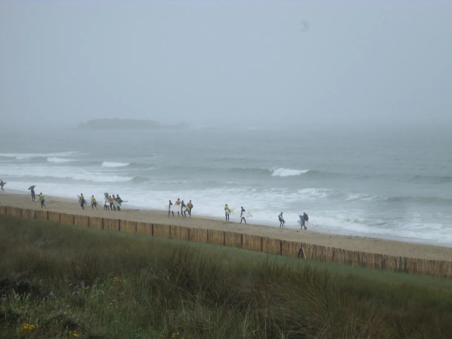
The maritime façade of Guidel stretches 4 km long from the mouth of the Laita river to the Fort du Loc’h. The coastline consists of long beaches: the beach of the Bas Pouldu or Guidel-Plages, located at the mouth of the Laita river are great! ; the Fort du Loc’h beach, and the Fort Bloqué beach. (see posts), These beaches are separated by rocky areas with low cliffs. The beaches of Guidel are a surfing spot. They are among the ten most favorable sites for the practice of this sport in Brittany.
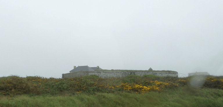
The town of Guidel has a multitude of monuments, such as the tumulus of Kerméné, the Fort du Loc’h, as well as remnants of WWII bunkers. It has several other tumulus, dolmen and menhirs. The Chapel of Saint-Mathieu , located in the district of Saint-Mathieu and whose characters and phylactery of the outer wall of the south transept are protected relics here. The Church of St. Peter and St. Paul ; 19C; partially rebuilt after WWII. The Chapel of the Madeleine: the present Chapel dates from 1883, but on the site of an ancient chapel dating from the 18C of which only the small steeple was preserved, having probably replaced an older Chapel, reserved for lepers. The chapels bearing the name “La Madeleine ” are for this reason built away from the agglomerations. The Chapel has statues of St. Anne, St. Herbot and St. Magdalene, as well as a painting; Mary Magdalene in front of the Lord’s feet. It has as well several other Chapels.
A bit of history I like tell us that on July 1342, six thousand troops, composed of Castilian (Spanish) mercenaries and Genoese crossbowmen, under the orders of Louis of Spain, dismounted at Guidel in Bas Pouldu after sacking the town of Guérande, while the fleet, made up of a hundred vessels which had brought them to port, anchored in the estuary of the Ellé river, the former name of Laïta. The objective of this military expedition was to take from the rear the stronghold of Hennebont, then held by the partisans of Jean de Montfort (helped by England) , by marching on Guidel and Pont-Scorff. This expedition ended in disaster since of the six thousand troops who landed, only 300 managed to re-embark, the others having been killed on the battlefield of Roscaquen en Rédené, killed by the Anglo-Breton soldiers of Gauthier de Mauny.
On October 1, 1746, as part of the War of the Austrian Succession, an English fleet of 52 ships, commanded by Admiral Lestock, landed 5,000 men at Pouldu (Bas Pouldu beach) in order to attack Lorient and seized the castle of Coëtdor. On October 2, 2000 enemies marched from the castle of Coëtdor and went to occupy the Moulin de la Montagne and the town of Plomeur; on 3 October they seized the town of Guidel and it was between these two towns that they began to form a camp where they took refuge; on the 4th October, they fired the cannon and summoned the garrison of L’Orient (Lorient) to surrender . All that was left to do was find the means to resist the efforts of the English. But once they arrived under the walls of Lorient, they did not dare to attack the city, when it was on the verge of capitulation. They re-embark on October 10, having lost only 20 men, and set sail for Quiberon. The Fontaine des Anglais (fountain of the English on rue Monistrol in Lorient, would have been used for the water supply of the English troops and would correspond approximately to the extreme point of their advance.
On July 12, 1795, Royalist troops from the Quiberon expedition led by Joseph de Puisaye, landed on the beaches of Sarzeau (4,000 Chouans and 100 emigrants under the orders of Vincent de Tinténiac) and Guidel (3,000 Chouans, under the command of Lantivy-Kermeno and Jean Jan, dressed in red clothes to make it appear that they were English troops in order to take the Republican troops led by General Hoche from the rear, but the attack and the resumption of Fort de Penthièvre by the Republicans,(in favor of the French Republic) routing the Royalist troops (oppose to French revolution), thwarted this plan.
After the withdrawal of Nazis troops in Brittany in August 1944, the town of Guidel found itself included in the Lorient pocket which remained held by the Nazis (Laïta river serving as a front line to the west) and suffered bombardments from allies. The military square in Guidel Cemetery houses the graves of 107 British, Commonwealth and Allied soldiers and sailors who died in WWII here.
The ports of the Lorient area on Guidel : https://www.ports-paysdelorient.fr/en/ports/port-de-guidel/
The town of Guidel on its heritage : https://www.guidel.com/decouvrir-guidel/fiche-didentite/patrimoine-architectural-et-naturel/
The Lorient South Brittany tourist office on Guidel: https://www.lorientbretagnesudtourisme.fr/fr/immanquables/guidel/
There you go folks, another dandy beautiful coastal town full of beaches and laid back lifestyle to boot. It is a must to come to Guidel and even better Guidel Plage!! Again, hope you enjoy the post on curiosities of Guidel Plage !!! as I.
And remember, happy travels, good health, and many cheers to all !!!


