
And on my saga of updating older posts and bringing back beautiful memories let me take you to the corsair city of Saint Malo. My first introduction to it was an old friend from a now defunct travel forum virtual tourist who lived in the city, a native of England. I came to see him with the family and voilà got the itch to be back for a visitor inquiry. Since then, several trips and posts in my blog. This one was sort of an introduction so here is my take on this is Saint Malo !!! Hope you enjoy the post as I.
I went up north to another department ,this time no 35 Ille-et-Vilaine and the wonderful fortified city of Saint Malo! Again, I have written in my blog on it but like to tell you more of the history and the intricate wall ramparts of this wonderful corsair city of upper Brittany!
Saint-Malo is the main port on the north coast of Brittany. The name of the locality is attested in the Latinized form of Macloviensem in 1162, then, Saent Madubugwu in 1282, Saint Malou in 1287 and in 1294, Saint Malo in 1304 during the revolution, the town was renamed Port-Malo, then Common-de-la-Victoire, then Mont-Mamet. On the coast of the channel and on the right bank of the Rance estuary. It is located 18 km north of Dinan, 75 km north of Rennes and 404 km from Paris. Saint-Malo is part of Clos-Poulet, a large peninsula bordered by the Rance, Manche and the depression of Châteauneuf. The coastline of the Clos-Poulet is part of the Emerald Coast, stretching from Cancale to Cape Fréhel. Saint-Malo is bordered by Dinard, but is separated by the estuary of La Rance. The tides of the Bay of Saint-Malo are among the most important in Europe. They are caused by the concentration of water in the heart of a triangular bay between Brittany and Cotentin.
Saint-Malo is connected to Rennes and Paris by train. In season there are also links with Granville and Lille Europe (on weekends only). Many residents leave each morning to work in Rennes and return in the evening, enjoying two stops in the regional capital; In addition to Rennes train station, Pontchaillou station serves the Pontchaillou hospital, schools and the Villejean University campus. The city center/ downtown with the historic city (old Saint-Malo), the city (old Alet) and the port, is formed by a complex coastline, with numerous reefs and marshes immersed in high tide, underwater tombolos, visible at the low tides of vivid waters , by islands or islets, many of which were fortified in the 17-18C such as Cézembre, Fort Harbour, fort de la Conchée, Grande Bé and Le Petit Bé, and the island of the Fort National.
Things to see and do, and there are plenty,see posts: The start of the Rum Route, a solo transatlantic sailboat race, takes place every four years, and the arrival of the Transat Québec-Saint-Malo as a crew which also takes place every 4 years! Saint-Malo is an active trading port, the second largest trading port in Brittany. It is composed of four basins, the Vauban basin, the Duguay-Trouin basin, the Jacques-Cartier basin and the Bouvet Basin. The port of Saint-Malo on passenger service to or from Great Britain, Ireland, Jersey or guernsey. The avant-port of Saint-Malo has two recent and efficient ferries terminals, the Naye Ferry terminal and then the Bourse terminal. Four lighthouses mark the various access channels: The Grand jardin, the Balue, the Bas-Sablons and Rochebonne.
St. Vincent’s Cathedral, (see post)in Romanesque and Gothic style. It was the former seat of the bishopric of Saint-Malo until 1801. Dedicated to Saint Vincent of Zaragoza,and the Evangelist Church of Saint-Servan; The Church of St. Croix; The Church of Saint-Sauveur are nice ones to see. The Château de Saint-Malo, (see post) which now houses the city/town hall, was built by the Dukes of Bretagne, its dungeon currently houses the Museum of History of the city and the Malouin country. Integrated in the northern part of the enclosure by the Porte Saint-Thomas, it separates-southeast of the Porte Saint-Vincent-by an interruption, the latter corresponding to the old moat which isolated it from the rest of the city.
The awesome here are the Ramparts !! : The Porte Saint-Thomas, the first of the name, because there will be two others. It opens between two towers, the old dungeon, and the square tower; A second Porte Saint-Thomas is opened in the northern rampart, in front of the tower Quic-en-Groigne, allowing to leave the city. The second gate St. Thomas is destroyed with the old rampart and rebuilt in the new between 1737 and 1742. It is the third gate St. Thomas, which overlooks the cale and the Evantail beach it still retains the old elements of the counterweight of its door.
The Grand Porte( big door), also called: the Sea Gate, because originally, the boats came to moor there. It consists of two towers with a firing platform with machicolations to quadruple heights. It’s the oldest door. The statue of Our Lady of Bon-Secours, placed in a niche at the top of the door dates according to the experts from the early 15C and seems to be already in place in 1439. The guard placed at the top, destroyed by a fire in 1661, caused some damage requiring restoration and was rested and blessed in 1663. It is white limestone, and was polychrome. It suffered the outrage of time and people, thrown down and burned at the French revolution, it was finally restored and re-established. The original is now is in the shelter and is replaced by a copy. It has been credited with many miracles.
The Poterne de la Croix du Fief (Fief Cross), which disappeared during the first expansion (1708-1742), was replaced by the Porte Saint-Vincent during the expansion of 1709. The Poterne Brevet, destroyed in the second expansion (1714-1770), replaced by the Porte de Dinan, on the axis of it which happened to be at the corner of the current rue d’Estrées, the old ramparts, and porte de Dinan, giving access to the square. The Poterne of Bon-Secours (1751-1871). In the event of danger, the poternes (small gates) was walled. The Porte Saint-Vincent, it was built between 1708 and 1710 and is part of the first expansion of the city called the Fief. The Poterne d’Estrées, opened in 1933, between the bastion of Holland and that of Saint-Philippe, opens on the beach of the Mole, and faces the rue d’Estrées. By Northern wind and stormy days, the water goes through there too. The Poterne aux Normands, its name probably comes from the rocks lying opposite the stones to the Normans. It was rebuilt after the bombardment and fire of 1944. The Poterne Jean de Chatillon, opened in 1757, condemned in 1871, during the opening of the Porte Saint-Pierre, it was reopened in 1958. She was called Poterne bon-secours , until 1971, and a poterne de la surveillance during the French revolution. It gives rue de La Crosse and allows access to the bon-secours square.
The Porte Saint-Louis, pierced in the curtain wall, in 1721, during the third expansion, it was opened only in 1874. It faces the Vauban basin, on the Quai Saint-Louis, and inside the city, at the rue de Toulouse and the Rue de Chartres. The Porte de Dinan, in the 18C, called the Porte de la Marine ( Navy), or Porte de l’Evéche (bishop), because it was by this one that he made his first entrance into the city. It was built in 1714. The Porte Saint-Pierre, opens on the beach of Bon-Secours. The Porte de Bés, it overlooks the beach of Bon-Secours, and was opened in 1884 to facilitate the access to the Petit-Bé at the foot of which the steam boats arrived from Dinard. It was carried out in the Tower of Notre-Dame, also known as the La Découvrance (discovery). It is from this place that the watch saw on November 26, 1693, the English fleet anchored under the Conchée, ready to assail the city. The Porte de Champs Vauverts, opened in 1879, it overlooks the rocks that surround the tour Bidouane, and allowing access to the square of Malo and Bon-Secours. Easy access to the Grand Bé and Petit Bé islands
There are numerous sites to see, however, my favorites are; Les Remparts or wall defense area around the harbor of about 1754 meters long, dating as old as the middle ages. There are intact from 1944 on…The Chateau, housing the musée d’Histoire in the grand donjon from the .15C; fortification by Vauban in 1500. The Maison de Corsaire, most of the facades recontructed after WWII, see the wonderful hotel d’Asfeld, 18C used during the French revolution as a woman prison. The Fort National and Fort du Petit Bé ,built during 1689 on planning by Vauban in the bay of Saint Malo, they can be reach on low tides only . The le Grand Bé, in 1848 the writer François-René de Chateaubriand was buried here,and it can reach in low tides. The wonderful three mast boat Etoile du Roy a replicate of a corsary frigate of 1745, wonderful museum. The Tour Solidor is a wonderful place just outside intra muros in the quartier of Cité d’Alet,considered the oldest part where the original Saint Malo was founded; here on the donjon of the tower you have a musée des Cap-Horniers, in honor of the locals who were the first discoverers in the 17C. There is a petit train or little train, we didn’t took as we are used to walking but could be a respite for many and allows you to get an overview of the town, and it stops by the main gate porte Saint Vincent next to Chateau.
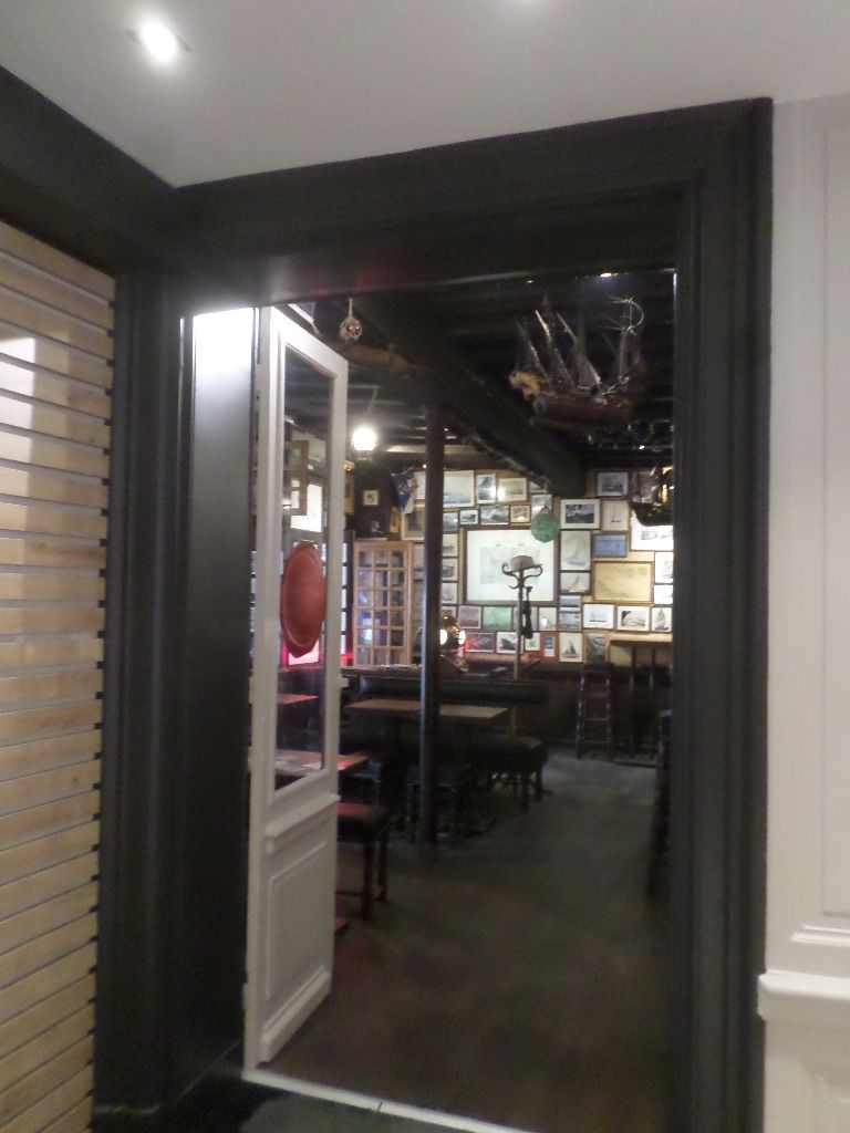
We live close enough to come here for the day, but one time we splurge on the surroundings and stayed two nights in a hotel, I decided to rent the Hôtel de l’Univers very popular in town. It is located at the Place Chateaubriand, The L’Univers, is a legendary bar in Saint-Malo. It is also a 64-room hotel, one of the largest in Intra muros The hotel is opened since 1850 and the wooden bar, built from a 1668 corsair chest, found on a farm near Château-Malo.. This mythical bar of Intra-muros, born in 1923, long housed the first yacht club of the corsair city. It has remained a rallying point for sailors and Saint-Malo residents. The corsair chests that serve as a counter alone take you on a journey through time and the seas of the world.
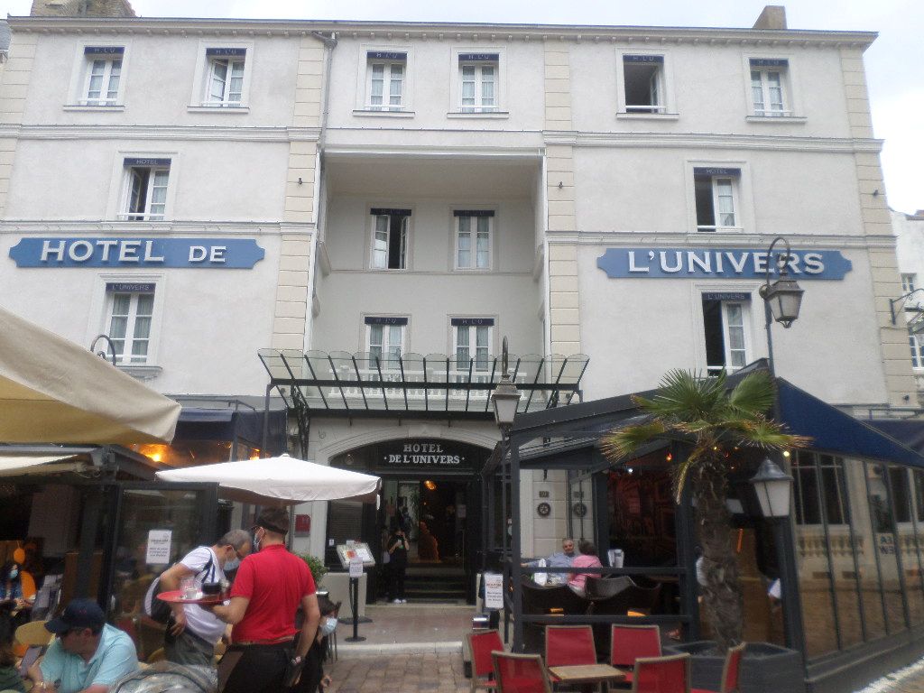
My take is that the reservation was done nice and the welcome friendly. Dogs were allowed in the hotel and the bar terrace, not in the restaurant. Ok for us. Upon arrival , the entry was flawless and we climb to the 4th level! The elevator or lift remind me of mine while living in Madrid early 70’s good going down but slow heavy going up , old! And with a space maximum of two persons! tight. There is no parking the hotel tells you that right away so we parked at the Q Park Saint Vincent expensive but for two nights it was ok for the convenience just across the porte Saint Vincent and the hotel, rate 34 euros per day. Our dog Rex was 10 euros per night extra too ok fees.
Not to be outdone ,there are good beaches here, we look at plage de Bon Secours,right in the middle area from intra muros and a wonderful pool with diving deck right in the ocean! plage du Mole is a bit secluded under the remparts and our favorite for its sandy white sand and tranquil waves. the beach or plage de l’Eventail is nice just below the chateau with a large cafe on beachside. Just outside the city limits there is the Saint Malo aquarium I must say was a welcome relief and nice laidout, including a dive into the Nautibus submarine ride and the big fish and sharks tanks was nice. You ,also,have a petting fish tank lol!!! nice for the entire family. You have free parking !!! and you end up here on the N137 road at the entrance of Saint Malo.
A bit of history I like tell us that De Canalchius (from the Old Gaul Canalch) became over time the intra-muros Saint-Malo. It’s on this one, surrounded by the islets of the Grande, the small and the National Fort accessible at low tide, lined with those of Harbour, Cézembre and Conchée in the studded harbor of multiple rocks, that the hermit Aaron welcomed a monk from what Will eventually become Wales: Maclow, Malo or Manail, the future Saint-Malo. On March 11, 1590, Saint-Malo declared its independence from the Kingdom of France and became the Republic of Saint-Malo. The four-year episode will end on December 5, 1594 with the conversion to Catholicism of King Henry IV . It is with the discovery of the Americas and the development of trade with the Indies; The shipowners became more numerous and characters of that period made famous the city, these were Jacques Cartier (discovered and explored Canada), and the Corsairs harassed the enemy merchant and military Marines, such as Duguay-Trouin, and later Surcouf.
During WWII, Saint-Malo and its surroundings were fortified by the Nazis as several ports of the Atlantic façade. The Festung (fortress) Saint-Malo becomes even as the entire coastal zone of restricted access. During the liberation of the city in August 1944, this Nazi garrison is actually located on the city of Aleth. These bombings and the fires they trigger destroyed 80% of the old town. The Nazis on the island of Cézembre will still resist for almost a month, only after intensive shelling by land, sea and air, including the use of napalm bombs.
The city of Saint Malo on tourism info: https://www.saint-malo.fr/accueil/sortir/tourisme/
The Saint Malo tourist office on its heritage: https://www.saint-malo-tourisme.co.uk/our-8-preserved-treasures/saint-malo-le-bijou-corsaire/
The Ille et Vilaine dept 35 tourist office on Saint Malo: https://www.ille-et-vilaine-tourism.com/discover-ille-et-vilaine/the-loveliest-places/saint-malo/
The Bretagne region tourist board on Saint Malo: https://www.brittanytourism.com/destinations/the-10-destinations/cap-frehel-saint-malo-mont-saint-michel-bay/saint-malo/
The official Hôtel de l’Univers : https://www.hotel-univers-saintmalo.com/
There you go folks, a must to visit in my lovely Bretagne; this is Saint Malo, the famous city of corsairs. Do see my many posts on the city and its monuments in my blog. Again, hope you enjoy this post on this is Saint Malo !!! as I
And remember, happy travels, good health, and many cheers to all !!!

I love St. Malo, very Celtic (or should that be Celtique?). I remember spending a wonderful afternoon in a bar there, just the barman and I, chatting and listening to Dan Ar Braz, Pierre Bensusan etc. It was great fun and he even gave me a little Breton flag patch to sew on my rucksac. I never got round to doing that but I think I still have it somewhere.
LikeLiked by 1 person
Yes indeed thanks for stopping by. I saw Paul there a couple times. cheers
LikeLike
Lovely city, I spent a very good day there in 2015.
LikeLiked by 1 person
Yes it is thanks for stopping by
LikeLike