
On my road warrior tour of my coastal beautiful Loire Atlantique I am taking you back to a wonderful sight in Saint Nazaire in my belle France why not a bridge! I have passed it on several occasions and always wonderful, Of course this is in the Pays de la Loire region and formerly my Bretagne. I have another post but will update this older one with new text and links for you and me, Therefore, here is my take on the Pont Saint Nazaire, part II !!! Hope you enjoy the post as I.
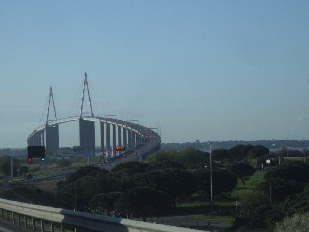
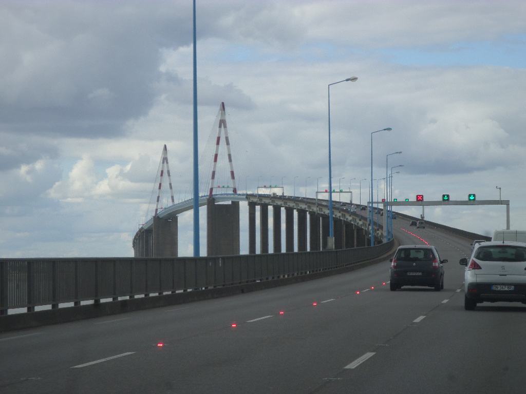
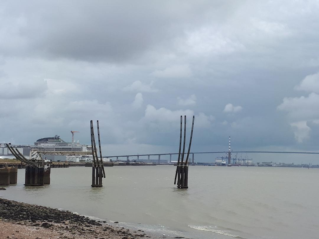
The Pont Saint-Nazaire is a cable-stayed multi-cable bridge that spans the Loire estuary and connects the city of Saint-Nazaire to the district of Penhoët, via the town of Montoir-de-Bretagne where the bridge takes actually footing on the right bank to the north, at Saint-Brevin-les-Pins on the left bank to the south. The bridge, supporting the Route Bleu D 213,and was inaugurated on October 18, 1975. The name Pont de Saint-Nazaire is a common name, this bridge has no official name. One of the prettiest car ride you can make along the route bleu D213 over the bridge!
The Pont Saint Nazaire was given its first stone on November 4, 1971, the works really began in March 1972 and after three years of construction, the bridge is put into service, on October 18, 1975. It has a central span of 404 meters, the structure 720 meters metal bridge holds the world span record for a cable-stayed metal bridge during its construction for eight years. Access to the bridge becomes free by removing the toll, October 1, 1994, sixteen years before the scheduled date! The Pont Saint Nazaire has been crossed by the Tour de France in 1993,1997,1999, 2000 and 2011 !!!.
The speed is limited to 70 km / h, two section radars have been in service since 2012, the measurement is made at the front of the vehicles approaching in a north-south direction and at the rear of the vehicles moving away in the south-north direction. Strictly enforce! The circulation can be prohibited with certain vehicles, even with all, by strong wind with rules : In the event of a wind greater than or equal to 50 km/h: display of automatic prudence messages on the panels located on both sides of the structure. In the event of a wind greater than or equal to 80 km/h: closure of the central route of the structure and therefore prohibition of exceeding. Speed limitation to 50 km/h. Prohibition to travel to two-wheelers, vehicles towing a caravan or a trailer. In the event of a wind greater than or equal to 120 km/h: complete closure of the structure.
In order to offer an alternative crossing mode to the bridge for pedestrians and cyclists during the summer period (from July 1 to September 1 2024 check for other years), the Loire Atlantique department offers a free shuttle with trailer which allows crossing the structure in complete safety. This navette is taken in Saint-Nazaire, boulevard des apprentis,at the corner with rue de l’aviation, and in Saint-Brevin-les-Pins,at place Bougainville.The only regular bus lines using the bridge and ensuring intercity connections between Saint-Nazaire and the country of Retz, are those of the Aléop network on lines 315, 316 and 317. Line 317 vehicles are equipped with spaces reserved for eight bikes. The official Aléop bus network : https://aleop.paysdelaloire.fr/mes-deplacements/mon-reseau-aleop
A bit on the Saint Nazaire bridge tell us that the structure consists of two pre stressed concrete access viaducts, 1,115 meters to the north and 1,521 meters to the south, and a main metallic cable-stayed structure 720 meters long. It is taken by the Route Bleu D213. Independent viaduct with pre stressed beams: 22 spans to the north and 30 spans to the south, with a span of 50.70 meters; 208 pre stressed beams 2.80 m high and 190 tons; a slab width of 13.5 meters between railings offering 12 meters of roll able width (used in 3 lanes), and two service passages of 0.75 meter; and longitudinal slopes of 5.6%.. A cable-stayed metal box 720 meters long and 3.20 meters high, in 3 spans of 158 meters, 404 meters and 158 meters, with an orthotropic slab 15 meters wide; A draft of 61 meters above the lowest water, 300 meters wide; 72 shrouds, in 4 fan plies, attached to two inverted V metal pylons, articulated at the bottom, and whose head is located substantially 130 meters above the lowest water level. The manufacture of the two 96 meters sections of each shore span, supplied by sea from the Fos factory, through the Strait of Gibraltar; assembly on two barges of each shore span 192 meters long with 34 meters overhang in central span; hoisting of the assembled box and of each coated pylon, by racks and jacks; lifting of pylons; successive hoists in the central span of the 16 meters sections and setting up and adjusting the advancement of the shrouds; keying. The current piles (52, not including 2 abutments) consist of two H-shaped drums from 3 meters to 57 meters in height, resting on a base based on four piles of 1.80 meters or 1.50 meters in diameter. Two main piers on either side of the channel are hollow and formed of four vertical cells based on a group of 18 piles 1.80 meters in diameter. The set of reinforced concrete piles, cased and anchored to the rock , vary in length from 15 to 50 meters. The piers were built by sliding formwork. Of course the above translated from the infotraffic source below.
The Saint Nazaire tourist office on the bridge: https://www.saint-nazaire-tourisme.uk/offers/pont-de-saint-nazaire-saint-nazaire-en-2500782/
The Inforoutes traffic information on the Saint Nazaire bridge : https://inforoutes.loire-atlantique.fr/44/pont-de-saint-nazaire/pont-de-saint-nazaire/info_60136
The town of Saint Brévin les Pins on the Pont Saint Nazaire: https://www.saint-brevin.com/pont-de-saint-nazaire-saint-brevin.html
There you go folks, another happy motoring ride in beautiful Loire Atlantique dept 44 old Brittany ,and along the Atlantic ocean coast of my belle France. This is a ride I would recommend for the adventurous in us,,,,, Again, hope you enjoy the post on the pont Saint Nazaire, part II as I.
And remember, happy travels, good health, and many cheers to all !!!
