
I am again to tell you about more streets of my eternal Paris. I have many many posts on Paris and several on the streets of the most beautiful city in the world. I have come up with pictures from cd rom vault that should be here for you and me. As always thank you for following my blog some since Nov 26, 2010. Therefore, here is my take on the streets of Paris, part XXXI !!! Hope you enjoy it as I.
The Rue Lepic is located in the Grandes-Carrières quartier or neighborhood of the 18éme arrondissement or district of Paris. It is one of the most renowned streets on the Butte Montmartre, depicted by numerous painters, including Maurice Utrillo. The street is in cobblestone that climbs to the top of the Butte Montmartre with a gradient of approximately seven percent. This site is served by metro line 2 at the Blanche station. It is named after General Louis Lepic, who distinguished himself at the Battle of Eylau in 1807. A former street in the village of Montmartre, this street was created by straightening and developing several dirt roads and paths leading from the Barrière Blanche, Place Blanche, to the top of the Butte Montmartre. One day in 1809, Napoleon I decided to go to the Saint-Pierre Church to see the Chappe telegraph installed there. At that time, access to the church could only be made via the “Vieux-Chemin”, now Rue Ravignan (see post). This path was in very poor condition and the Emperor was forced to finish on foot, leaving his horse at the height of the current Place Émile-Goudeau (see post). The priest, Jacques-Christophe Cayres de Blazère, pointed out to him the interest in creating a street with a slope more suited to traffic. The Emperor gave him satisfaction by creating the current rue Lepic. First called “chemin Neuf” – the “Vieux-Chemin” being the current rue Ravignan – this road took in 1852 the name of “rue l’Empereur” then that of “rue Royale” and finally in 1864 its current name.
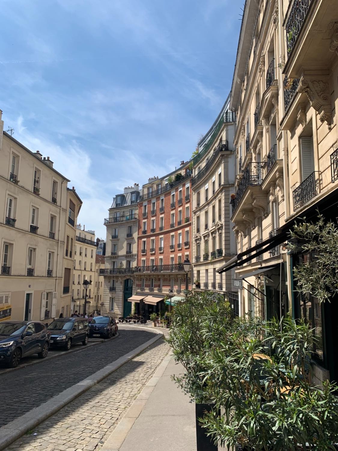
Notable buildings here , me think are at No. 1: Hôtel Beauséjour, where Jules Pascin, an American painter, draftsman and engraver of Bulgarian origin, settled. Originally influenced by German Expressionism, sometimes called Fauvist, long associated with the School of Paris or a hypothetical Jewish School (alongside Modigliani, Chagall, Soutine) and his mistress, Hermine David, from 1907 to 1909. No. 15: Café des 2 Moulins, where scenes from the film Le Fabuleux Destin d’Amélie Poulain were filmed. No. 50: Studio of the painter Edgar Degas. The songwriter Jehan Rictus lived there from 1918 to 1933, No. 53: Jean-Baptiste Clément, author of the song Le Temps des cerises, lived there in 1880 after the return of the exiled Communards. He then went to live in 1891 at no. 110. Home of Pierre Jacob, poet and songwriter, author of the song Rue Lepic, sung by Yves Montand and Lucien Jeunesse. No. 54: the painter Vincent van Gogh and his brother Théo lived on the third floor from 1886 to 1888. The painter Armand Guillaumin also lived on the first floor. No. 64: the satirical cartoonist Jean-Louis Forain lived there in 1910. No. 65: between this number and no. 21 avenue Junot, site of the Moulin Neuf built in 1741 and destroyed in 1853. In 1897, the painter Alexandre-Claude-Louis Lavalley had his studio in pavilion C. No. 68: the poet Paul Fort moved to the ground floor around 1900 with the poetess Margot-mon-Page before living on rue Gay-Lussac. No. 72: studio of the painter Félix Ziem who died there. The Romanian sculptor Victor Brauner set up his studio there. The French poet, translator and critic Yves Bonnefoy lived there No. 73: between this number and no. 13 avenue Junot, site of the Moulin Vieux, the first of the mills built at the top of the hill (already mentioned in 1591) which disappeared in 1860. No. 77: the Moulin de la Galette and the Moulin Radet. Nos. 85 and 87: site of the Moulin de la Petite-Tour or Tour-à-Rollin, built in 1647, No. 87: one of the many places of residence in Montmartre, after 1882, of the painter Adolphe Willette, also that of the printers and engravers Auguste and Eugène Delâtre, who settled there after leaving no. 92 and before settling at no. 97, and then at no. 102 of the same street, Nos. 89 to 93: site of the mill de la Vieille-Tour built in 1623. Nos. 95 to 99: site of the Moulin du Palais built in 1640. The guinguette annexed to it was famous in 1712, No. 96: building painted by Vincent van Gogh where the painter Gen Paul was born, No. 98: the writer Louis-Ferdinand Céline moved there in 1929 with the dancer Elizabeth Craig. Céline wrote his two most important novels there, Voyage au bout de la nuit (1932) and Mort à crédit (1937). He lived there until 1941, then moved to 4, rue Girardon. The apartment was notably bought by Dalida and inhabited by Bernard Morlino No. 102: approximate location of the Moulin de la Grande-Tour built in stone and disappeared before the French Revolution. Last studio of the engraver and painter Eugène Delâtre, Anecdotes here are many , my favorites :In September 1960, Fernand and Jackie Sardou opened the cabaret Chez Fernand Sardou in place of the Belzébuth cabaret. Singer Michel Sardou made his debut there, first as a waiter. During the 2024 Summer Olympics, the men’s and women’s road cycling events will pass through Rue Lepic, drawing large crowds to the sidewalks of the cobbled uphill street. Echoing the Paris 2024 Olympics, the 2025 edition of the Tour de France will see the peloton pass through this now legendary street three times ! Awesome !!!
The Paris tourist office on the 18éme arrondissement de Paris : https://parisjetaime.com/eng/article/explore-paris-s-18th-arrondissement-a832
The Paris tourist office on rue Lépic : https://parisjetaime.com/eng/transport/rue-lepic-p1996
The Rue Saint-Martin is located in the 3éme and 4éme arrondissements of Paris Centre. Currently, the 1,420-meter-long street is part of the 3éme arrondissement, Arts-et-Métiers and Sainte-Avoye quartiers or neighborhoods, and the 4éme arrondissement, Saint-Merri quartier or neighborhood. The street begins at 8-12 Quai de Gesvres and ends at 1 Boulevard Saint-Denis and 55 Boulevard Saint-Martin. The street is extended beyond Porte Saint-Martin, by Rue du Faubourg-Saint-Martin. It is served by metro line 4 at the Châtelet, Les Halles, Étienne Marcel, Réaumur – Sébastopol and Strasbourg – Saint-Denis stations. It takes its name from the former Saint-Martin-des-Champs priory, now assigned to the National Conservatory of Arts and Crafts (CNAM), to which it leads.
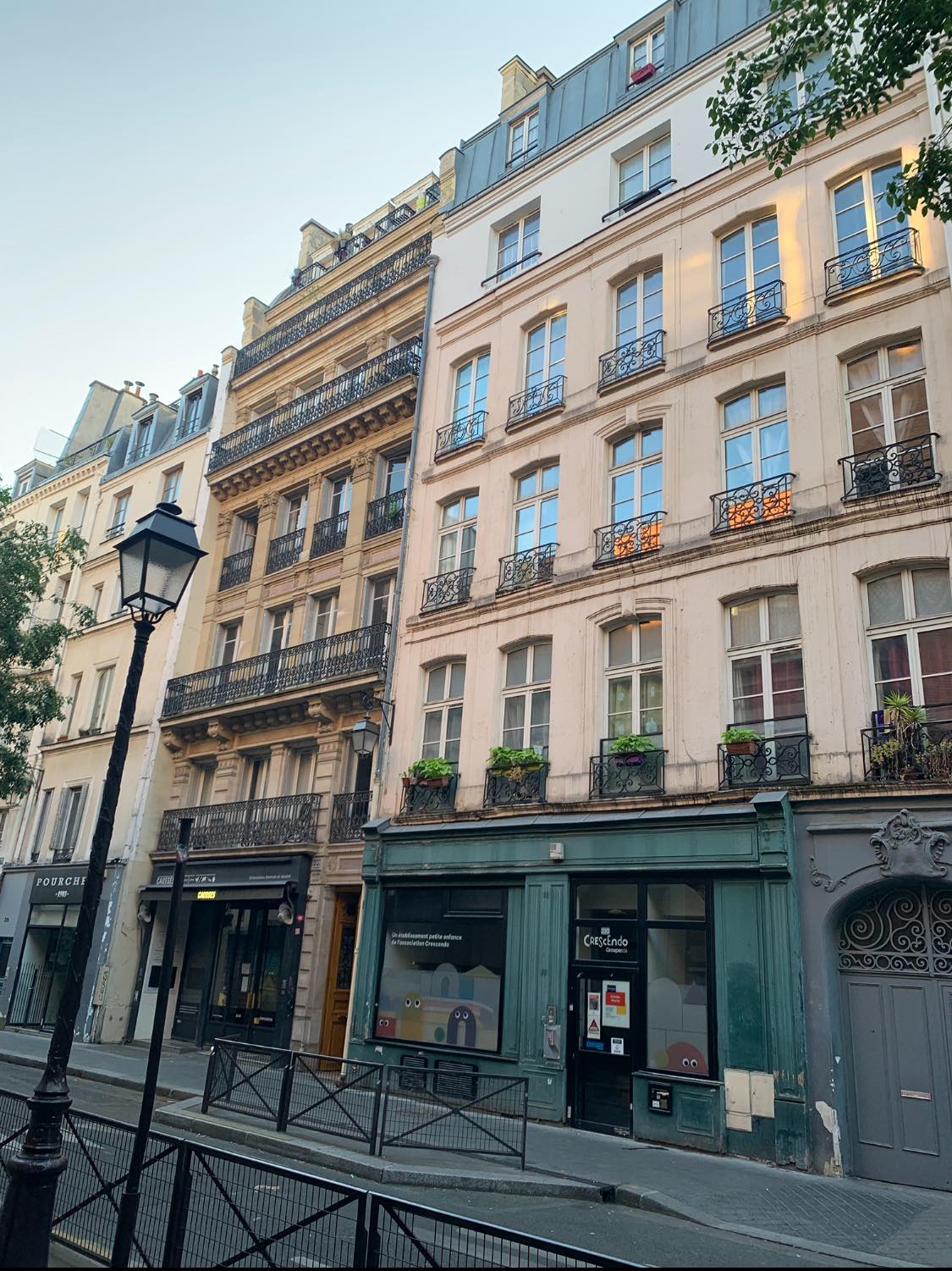
Originally this street, which was a path, was the extension of the Via Superior. Located on the right bank of the Seine, this cardo maximus was a raised causeway that crossed floodplain marshes and led from Lutetia to Louvres and Senlis. Around 1147, the rue Saint-Martin, which began at the Seine river, was almost entirely built up to the rue Neuve-Saint-Merri where there was a city gate, the Archet Saint-Merri, which was part of the second wall of Paris, probably built following the great siege of 885 by the Vikings. Around the year 1200, it was almost completely lined with buildings up to the rue du Grenier-Saint-Lazare where there was a gate of the third wall of Paris begun in 1188, by order of Philippe Auguste. This gate was later renamed “Faulce Porte”, so as not to confuse it with the new Porte Saint-Martin (see post) of the Charles V enclosure. In 1231, it was called “Rue Saint-Martin-des-Champs” and is cited under the name of “Rue Saint-Martin”. the name “La ruèle des planches de Mibray”, between the current Rue de Rivoli and Quai de Gesvres, In the 14C several houses on this street belonged to the chapter of Notre-Dame de Paris. This street became in the Middle Ages the major north-south axis of Paris until the relocation of the Grand-Pont, Rue Saint-Denis. In 1418, Rue Saint-Martin extended to Rue Neuve-Saint-Denis. It was finally under the reign of Louis XIII that it reached the location that still serves as its boundary today. The street was also lined with numerous religious centers. Some were completely destroyed, such as the church of Saint-Julien-des-Ménétriers, or partially, such as the priory of Saint-Martin-des-Champs, but most still exist, such as Saint-Merri and Saint-Nicolas-des-Champs. It was as long as it is today, limited to the south by the Seine, and to the north by the wall of Charles V. In the middle of the 17C, Paris being declared an open city, the medieval gate was replaced by the Baroque gate, which can still be admired today. It was also during this period that the street was renovated. During the Wars of Religion in 1590, during the Siege of Paris, the street was bombarded by the artillery of King Henry IV of France. During the French revolution, some religious centers were destroyed, and the Priory of Saint-Martin was converted into the National Conservatory of Arts and Crafts.(see post), In 1817, the Rue Saint-Martin, 1,160 meters long, began at 2, Rue des Lombards and 78, Rue de la Verrerie and ended at 1, Boulevard Saint-Denis and 61, Boulevard Saint-Martin. The street numbers were black. The last odd number was 317 and the last even number was 262. In 1851, Prefect Georges Haussmann planned the widening of the street, from 7.20 meters to 22 meters along the entire street, and 100 meters in front of Saint-Nicolas-des-Champs Church (see post) ,which was finally widened to only 37 m. But his project was never completed, and was only carried out south of the Rue des Lombards and the Rue de la Verrerie and between the Rue de Turbigo and the Rue Notre-Dame-de-Nazareth, thus losing its status as a major north-south axis of Paris, in favor of the Boulevard Sébastopol, opened in 1853, and the widening of the Rue du Renard and Rue Beaubourg, in 1907 and 1910. This is why today the Rue Saint-Martin appears narrow.
Notable buildings here , me think are the tour Saint-Jacques tower; No. 72: the writer Gérard de Nerval lived here with his father from 1815 to 1834. No. 78: Saint-Merri Church. No. 79: Saint-Fiacre impasse. No. 80 rue du Cloître-Saint-Merri: location of the Saint-Merri arch, former gate of the second wall of Paris. Place Marguerite-Porete. No. 89: House of the Annunciation, sculpted sign on the first floor, representing the Annunciation, that is to say the announcement made to the Virgin Mary of her divine motherhood by the Archangel Gabriel. The space separating No. 100 and No. 156 faces the Centre Georges-Pompidou, this section of Rue Saint-Martin and the Centre being separated by Place Georges-Pompidou. No. 113: The chemist and politician Marcellin Berthelot lived there from 1851 to 1861. No. 129 (corner of Rue de Venise): Maubuée fountain (formerly further south, at the corner with the now-disappeared Rue Maubuée). No. 135: In 1973, the artist Brion Gysin, a performance artist, a poet, An American-Canadian writer and painter moved into this building. From his window, he took the photo series The Last Museum, now kept at the Centre Pompidou. No. 156: Entrance to the building Piazza Beaubourg, part of the Quartier de l’Horloge. This name refers to the Place Georges-Pompidou, often called Piazza Beaubourg. No. 157: Passage Molière. No. 160: In the central arcade, above the pedestrian gate, a sculpted cartouche bears the imperial system number 88. Nos. 168-170: Location of the chapel and hospital of Saint-Julien-des-Ménétriers. Gérard de Nerval A major figure of French Romanticism, the “purest of French Romantic writers” was born here. No. 200: location of the Porte Saint-Martin of the Philippe Auguste enclosure. Nos. 203-203 bis: location of the house where Guillaume Bud, a French humanist, was born, also known under the Latin name of Budaeus; then called Hôtel de Vic. No. 223: entrance to the Passage de l’Ancre which leads to Rue de Turbigo. No. 226: address of the dye-works of Jean-Baptiste Jolly, who invented dry cleaning after his maid spilled kerosene on a tablecloth, No. 252 bis: Saint-Nicolas-des-Champs Church (see post), The quadrilateral between the streets Saint-Martin, du Vertbois, Montgolfier and Bailly marks the limits of the enclosure of the Saint-Martin-des-Champs priory, Nos. 270, 278 and 292: National Conservatory of Arts and Crafts (CNAM),(see post), former Saint-Martin-des-Champs priory. Vertbois fountain, at the corner with rue du Vertbois. No. 353: location of the Porte Saint-Martin (see post) gate of the Charles V enclosure. Triumphal arch of the Porte Saint-Martin gate.
The Paris tourist office on Paris Centre (old arrond 1-4) : https://parisjetaime.com/eng/article/explore-the-centre-of-paris-a846
The Paris touirist office on walks around Châtelet : https://parisjetaime.com/eng/article/walk-around-chatelet-paris-a923
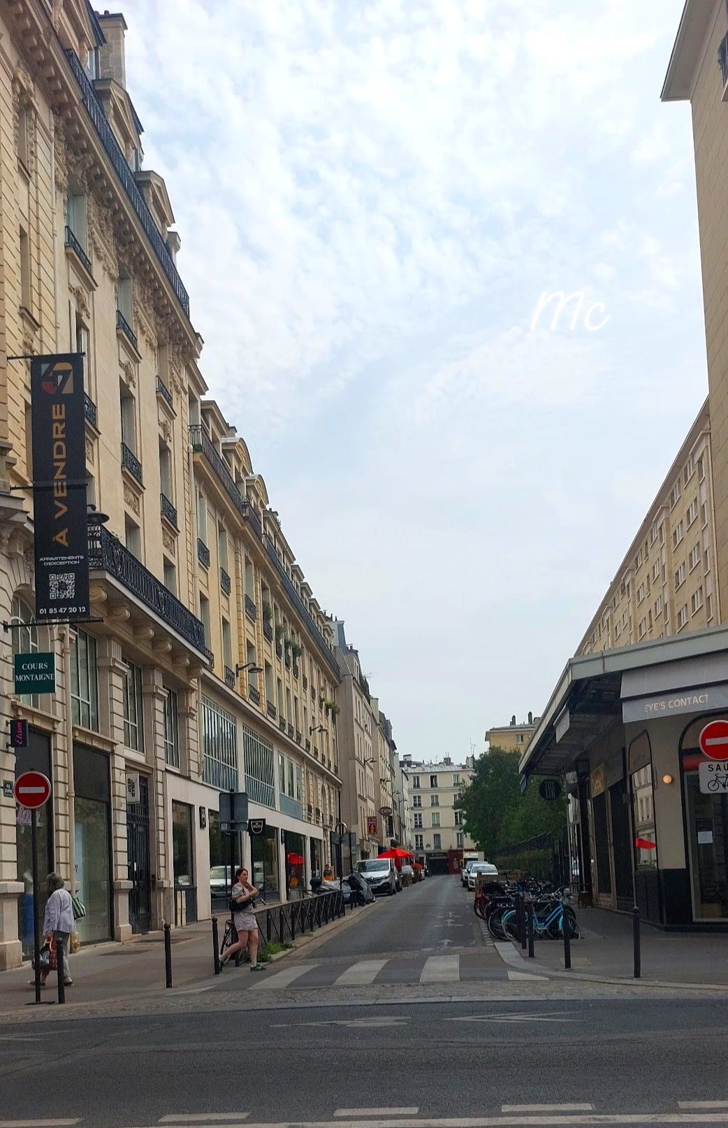
The Rue Dupin is located in the 6éme arrondissement of Paris. The street running from Rue de Sèvres to Rue du Cherche-Midi; it is 144 meters long and 12 meters wide. It takes its name from André Dupin , a French lawyer and politician. It is close to the metro lines 10 and 12 of Sèvres – Babylone station. This road existed in 1625. It was initially called “Rue du Baril-Neuf”, then “Petite Rue du Bac”. In 1864, it took the name of André Dupin. Concerning its former name “du Bac,” this originates from the fact that this street, along with Notre-Dame-des-Champs, Saint-Placide, and du Bac streets, was part of the path that once led to a ferry on the Seine. Notable buildings here ar at No 1 ,the Cours Montaigne, a private, non-contractual school founded in 1944. At No 5, there was once a post office, which gave its title to a book of interviews called “The Post Office on Rue Dupin. And Other Interviews Between Marguerite Duras and François Mitterrand.” Robert Antelme and Duras lived in the apartment upstairs. Mitterrand and Duras, who were to meet in this apartment in the spring of 1944, narrowly avoided arrest by the Gestapo. At No 15, Michel de Saint Pierre lived, a French writer and journalist who participated in the Resistance during World War II and later became politically active in favor of traditionalist and conservative Catholic options,
The Paris tourist office on the 6éme arrondissement de Paris: https://parisjetaime.com/eng/article/explore-paris-s-6th-arrondissement-a823
The Rue de l’Amiral-de-Coligny is located in the 1er arrondissement of Paris Centre. This street, perpendicular to the Seine, begins at the intersection of the Quais François-Mitterrand and Quais du Louvre and ends at Rue de Rivoli, opposite Rue du Louvre. It is bordered by the dry moat that precedes the Louvre colonnade; and for the most part, by the new Place du Louvre. It is served by metro Line 1 at the Louvre-Rivoli station. The street was named in honor of Gaspard II de Coligny, a Huguenot admiral of France, who was thrown from a window in the neighborhood during the St. Bartholomew’s Day massacre. A statue in his memory was erected in 1889 at the chevet of the Protestant temple of the Oratoire du Louvre, at 160 Rue de Rivoli (see post). This street, formed in 1972 by the renaming of the southern section of Rue du Louvre, itself created in 1853, occupies the site of an ancient road mentioned in 1205 as Rue des Poulies and which was renamed several times. It was renamed on the 400th anniversary of the St. Bartholomew’s Day massacre.Notable buildings here are the Louvre Palace presents its monumental main façade, known as the Louvre Colonnade, and the Place du Louvre offers a beautiful view of the former city/town hall of the 1er arrondissement of Paris, flanked by its belfry, both completed in 1863, as well as the Church of Saint-Germain-l’Auxerrois (13-15C) (see post); and the St. Bartholomew’s Day Memorial Garden, inaugurated on September 16, 2022.
The Paris tourist office on Paris Centre (former arrond 1-4) : https://parisjetaime.com/eng/article/explore-the-centre-of-paris-a846
There you go folks, another dandy beautiful set of glorious streets of my eternal Paris. I have criss cross them many and have many in my blog already, Again, hope you enjoy this post on the streets of Paris, part XXXI !!! as I.
And remember happy travels, good health, and many cheers to all !!!

I’ve been along all those streets and your descriptions conjure up each one.
LikeLiked by 1 person
Good for you ! When I worked in Paris used to come early or stayed late to walk these awesome streets then on weekends came with the family with our navigo passes to do more as Paris is a mouvable feast! thanks for stopping by Cheers
LikeLiked by 1 person
Pleasure
LikeLiked by 1 person