
And here I am very happy to have found these photos to write this post, long coming and deservingly so. I am back in my Caribbean sea!!! close ok. All started there for me and the Bahamas were my first “tourist” visit ever!from the USA…back in 1986! yes I have been around ::) Let me tell you now a bit on the Bahamas from the photos I found in my old vault! And I found more as these were on display in my house and not even notice, they are still in use today! A mug and an ash tray as souvenir gifts from my earliest trip out! Therefore, let me tell you about my first encounter, this is Freeport, the Bahamas !!! Hope you enjoy the post as I


The Bahamas, in the long form the Commonwealth of the Bahamas, located north of the Caribbean Sea. The Bahamas archipelago occupies approximately 700 islands and islets of the Lucay Islands located in the Atlantic Ocean, east-southeast of Florida, northeast of Cuba, northwest of Hispaniola and islands Turks and Caicos. Its capital is Nassau,(see post) located on the island of New Providence.
Grand Bahama is one of the northernmost islands in the Bahamas, 88 km from the Florida coast. The island is 154 km long with a maximum width of 27 km. The Spaniards called the island Gran Bajamar (great shallow sea) and it is undoubtedly from this name that the Bahamian Islands take their name. Yes indeed Bahamas is Baja Mar or shallow sea. In 1955, an American businessman named Wallace Groves entered into an agreement with the Bahamian government to build the town of Freeport under the terms of the Hawksbill Creek Agreement and manage the port with the Grand Bahama Port Authority (GBPA). An agreement, the Hawksbill Creek Agreement, with the Bahamian government dating from 1955, stipulates that Freeport companies will not pay any taxes until 2054. The port of Freeport is accessible to larger ships, and has a container terminal. The port also has a terminal for cruise ships, a container port, a private marina, and a boat maintenance service.
The Grand Bahama International Airport (IATA code: FPO • ICAO code: MYGF) is a private international airport located in Freeport. This is how I came to Freeport! The airport is at 100 km from the coast of Florida USA. The Bahamas Freeport airport: https://www.bahamas.com/getting-here/flying

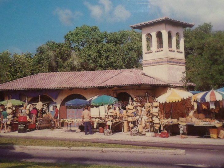
The straw market is very pretty colorful place, with small shops, restaurants … excursions nearby; near the marina and the other side of the beach and the casino. A fun place and great shopping indeed.
The Bahamas tourist authority on Freeport: https://www.bahamas.com/islands/freeport-grand-bahama-island
There you go folks, now I feel better to bring this nice island to the light, and my wonderful memories of my first trips abroad to the Bahamas islands. Freeport will stay in my vault of memories forever. Again, hope you enjoy the post on this is Freeport, the Bahamas !!! as I.
And remember, happy travels, good health, and many cheers to all !!!

Never been, looks charming
LikeLiked by 1 person
Thanks for stopping g by. Yes still beri british 😎
LikeLiked by 1 person
A very different but interesting scene, thanks for sharing.
LikeLiked by 1 person
Thank you for stopping by. Salut
LikeLiked by 1 person
Wow!! Those photos are ancient. I’m sure they are pre- 1986. Please come and visit us again. Here are a few things you probably missed:
https://www.writingsofamidlifeman.com/2018/11/15/1295/
LikeLiked by 1 person
About 1988 in my other life in the Americas.thanks for stopping by
LikeLike