
Well back to my dear Madrid again !! love it !! We came by car once by plane I like to continue the saga of our new road warrior experiences even if now with less in our family, This post is on my dear streets of Madrid of wonderful sublime Spain. I have these strays in my cd rom vault and feel they should be in my blog for you and me. Therefore, let me tell you aboutthe streets of Madrid, part V !!! Hope you enjoy the post as I.
At Calle de la Montera,33 is a forgotten shopping arcade that was once called the Pasaje de Murga or Pasaje del Comercio. Founded by businessman Mateo Murga in 1845, the Pasaje del Comercio was intended to attract a wealthy and elegant crowd. Despite its initial success, the arcade soon fell into a certain decline. Initially used as a bazaar for the Compañía General de Comercio, it later became a pedestrian area and changed its appearance. It was then that it opened a café, the Café del Pasaje, which enjoyed great success and which nothing of which has survived. In 1915, the printing press of González Linera, who published the Biblioteca Catón, moved here. Today, a few shops have settled in this corner that connects Calle de la Montera with Calle de Tres Cruces. Between the Gran Vía and the Puerta del Sol, The Passage has two covered sections separated by an open courtyard with shops on both sides. The courtyard is decorated with very flat pilasters with vegetal capitals supporting semicircular arches. The balconies feature very interesting ironwork.
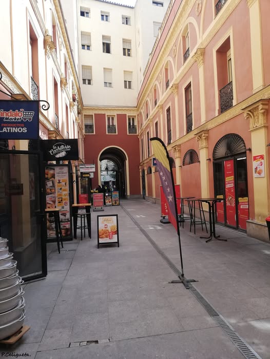
The history of shopping arcades begins in Paris at the end of the 18C, as a response to the heavy traffic in the City (lol!). Throughout the 19C, more than twenty shopping arcades or galleries were built around Puerta del Sol in Madrid. The first was the Pasaje San Felipe , built in 1839. A few years later, the Pasaje Matheu (see post) was built on land expropriated from the Convent of La Victoria, between Calle de Espoz y Mina and Calle de la Victoria, and completed in 1847. Later came the Pasaje Iris, which connected no, 11 Carrera de San Jerónimo with no, 12 Calle de Alcalá; the Commercial Export Gallery, located between Calle de Carretas and Calle de Cádiz; and the Pasaje Jordá, connecting calle de Espoz y Mina and Calle de la Victoria. They succumbed to the power of the real estate speculation. Two of them have barely survived to this day: the Pasaje de Carretas and this one the pasaje del Comercio (Murga). The project was to demolished some buildings resulting in the construction of a shopping arcade between Calle de la Montera and Calle de Tres Cruces. The arcade connected the two streets and adapted to the prevailing commercial architecture of the times,
The Madrid tourist office on Centro (Gran Via/Sol): https://www.esmadrid.com/en/madrid-neighbourhoods/sol-gran
The Plaza del Cordón is a historic 16C square between the Plaza Mayor and the Plaza de la Villa, crossed by Calle del Cordón in the old part of the city known as “Madrid of the Austrias”. A historic square that preserves its spirit with a unique medieval layout and has vestiges of 17-18C architecture despite its renovations. It once housed the Palacio del Cordón, a Renaissance palace that is a reference point for the area of stately homes around the Plaza Mayor, located where nos, 2 and 3 of the square are currently located. Opposite, at no, 1 on the square, is the Casa del Cordón, named after the decoration of its façade, an old stone cord. A renovated building with a simple and balanced design, built in the 18C. On the corner of the square, on what is now calle del Doctor Letamendi, stood the former 16C palace of Iván de Vargas, where, according to tradition, Saint Isidro, the city’s patron saint, lived as a servant. The space was renovated to become the current Iván Perez de Vargas Library, which retains original elements from the previous building, including the Renaissance courtyard. Other notable buildings in the area include the Casa de Cisneros, an example of 16C architecture; the rear of the 17C Baroque-style Convent of Las Carboneras; and the 18C Basilica of San Miguel.
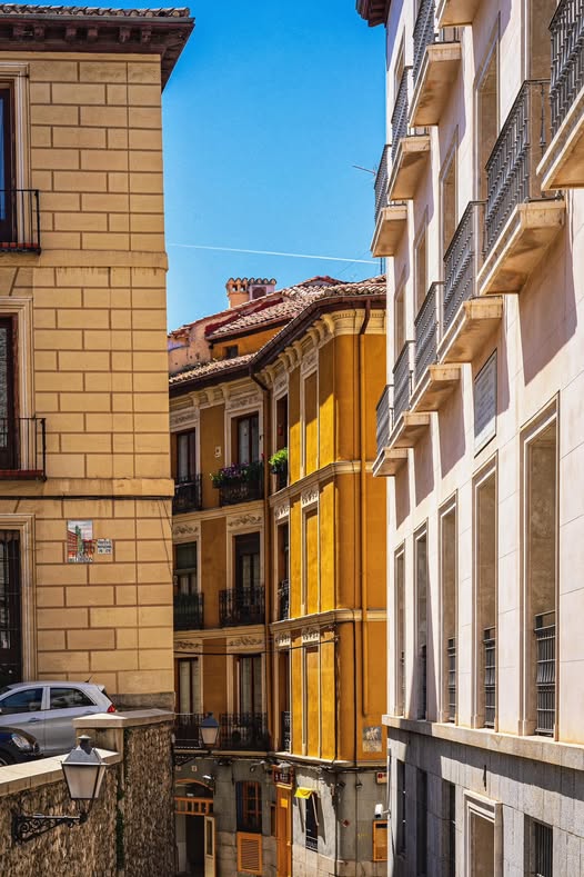
The calle del Cordón (see pic from the square) is a narrow, irregular street in Madrid, in the Palacio neighborhood of the Centro district. It runs north-south from Plaza de la Villa to Calle de Segovia, describing a short arc where it meets Calle del Doctor Letamendi and leading to Calle Sacramento On the right corner of Calle del Cordón , the only authentic remains of the Casa de Cisneros are preserved: a doorway with large voussoirs, a semicircular arch, and a balcony. Originally called the street that descends from Plaza de San Salvador to San Pedro, it was later known as Calle de los Azotados (Whipped ) until a municipal agreement in 1835 renamed it calle del Cordón, taking as a reference a legendary cord carved into a stone shield on one of the houses in the small Plaza del Cordon the northern end of the street. It was laid out on the original road that connected the churches of San Salvador and San Pedro el Viejo. It is not labeled as of 1656 and appears as Calle de los Azotados in 1769. There are records of private constructions from 1624.
The Madrid tourist office on the neighborhood of the Austrias : https://www.esmadrid.com/en/madrid-neighbourhoods/austrias
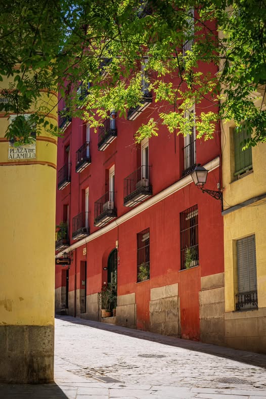
The Plaza del Alamillo has a length of 84 meters and is a small widening street to the Calle del Alamillo, a road that runs from the Costanilla de San Andrés to said square, where it meets the Calle del Toro, the Calle de Alfonso VI (see pic) ,and the Calle de la Morería. Different chroniclers agree that the origin of the Calle and Plaza del Alamillo date back to Arab Madrid, when they could have been one of the arteries of the Morería neighborhood of Madrid, where the Muslim neighbors stayed and resided since 1083, the year of the capture of Madrid by Alfonso VI. It should be noted that, with the aljama as the governing body, the Madrid Morería had its own institutional organization, different from the Christian one; Chroniclers suggest that the Arab Town Council met here during the Cordoban Caliphate of Hixén II ; after the Christianization process, and due to phonetic similarity, it ended up becoming “alamillo.” The plaza del Alamillo is an irregular square, with abundant vegetation and wooden benches. It is a small, rectangular square that preserves medieval elements. It consists of buildings from the late 19C and early 20C, built on three or more floors. The square is uneven, but is resolved with cobblestones and tree plantings.
The Madrid tourist office on the neighborhood of La Latina : https://www.esmadrid.com/en/madrid-neighbourhoods/latina
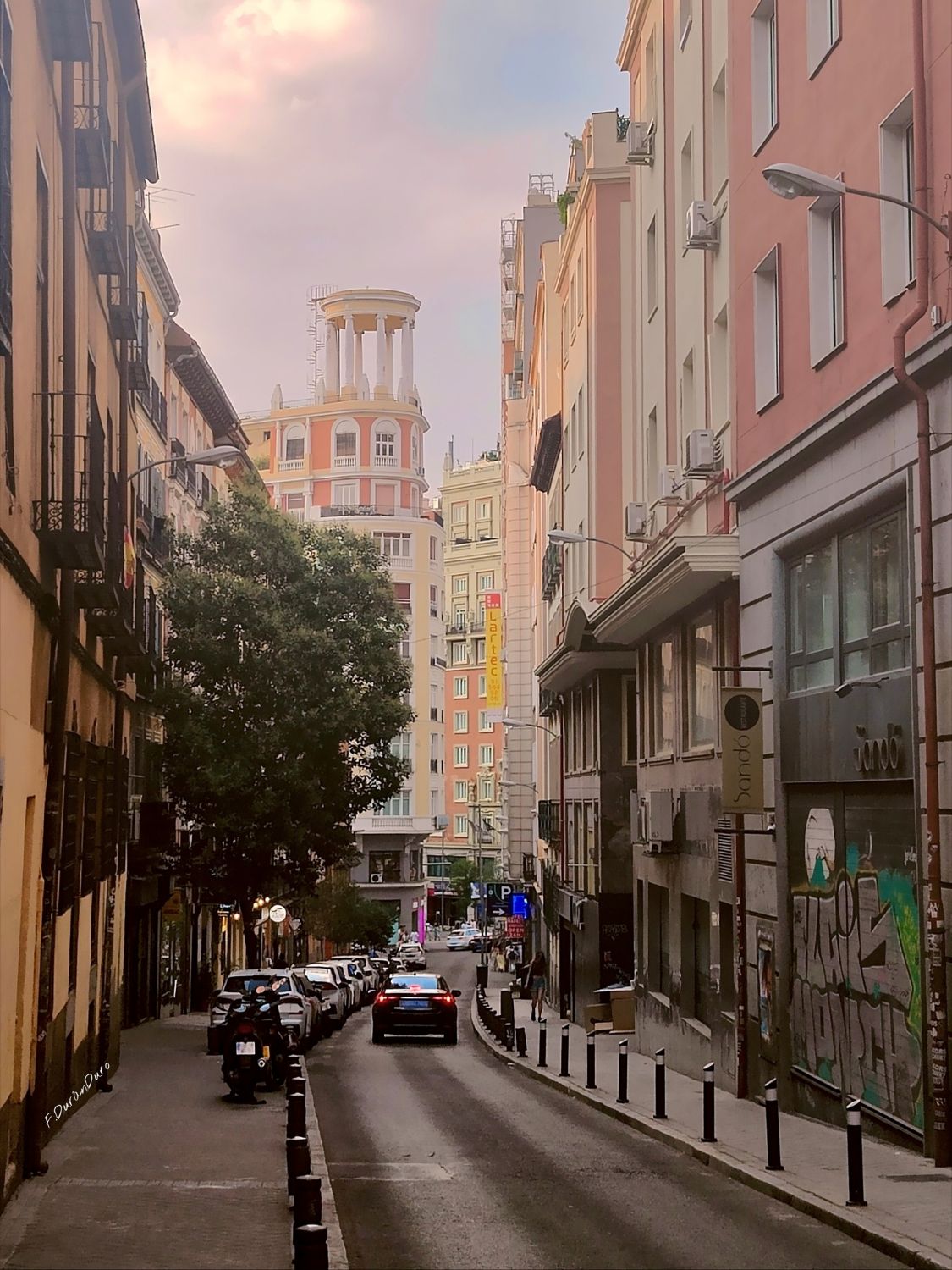
The Calle Isabel la Católica is located in the Palacio neighborhood, Centro district. The street runs from Plaza de Santo Domingo to Gran Vía. Having been known in other times as “Calle del Espíritu Santo”, “Calle de los Presmostenses”, “Calle de la Inquisición”, and “Calle de María Cristina”, its current name honors Isabel I of Castile, Queen of Castile and consort of Sicily and Aragon; Queen of Spain. The street has received its current name in 1855. Originally, it was called Espírito Santo because the church of the Premonstratensians convent was blessed on the day of the Holy Spirit, and Premostenses because the street led to the convent of the same name. Later, the street was named Calle de la Inquisición because the prison of the Holy Office was located at No 4 of the aforementioned street. . At the end of the 18C, it ceased to be the Tribunal of the Holy Office when the house on Calle Torija was built, which served as the residence of the Supreme Council and the inquisitor’s palace. From that moment on, the Court of Appeal and the prisons were located in the Isabel la Católica building. It was also named Calle de María Cristina because the street leads to the Conservatory of the Plaza de los Mostenses, founded by Queen María Cristina de Borbón. There is a convenient to Centro public parking lot APK2 Isabel La Catolica, at No 12, a 6-minute walk from Plaza España and close to the Callao metro station, and Gran Via.
The Madrid tourist office on district Sol-Gran Via (centro) : https://www.esmadrid.com/fr/quartiers-de-madrid/sol-gran
The calle de la Berenjena is a small street located in the Barrio or neighborhood of Cortes no 13, in the Centro district, which connects the Calle de las Huertas with that of Calle Moratín The street had already begun at the end of the 19C in the street of las Huertas, ending in the street of San Juan, later called Calle de Moratín, It was known since 1656 as Calle de la Berenjena , This legendary name supposes that it was an orchard planted with eggplants that belonged to the convent of San Jerónimo, according to some, or according to others, to the Marquis of Castañeda, gentleman of the chamber of King Henry IV, It is very close to Plaza Murillo across from the Prado museum passing near bus lines 6, 26, 32 and line 2 metro station Banco de España

The Madrid tourist office on the Barrio de las Letras (Cortes) as per Calle de la Berenjena: https://www.esmadrid.com/en/madrid-neighbourhoods/barrio-letras
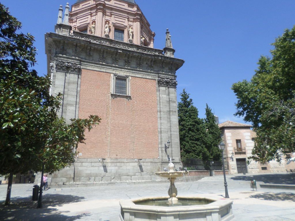
The Plaza de los Carros is a square located in the Palacio neighborhood, belonging to the Centro district, in the set of open spaces that form the Plaza de la Cebada, Puerta de Moros and Calle de Humilladero, in the axis of the Carrera de San Francisco and surrounded by the Costanilla of San Andrés and the Calle de Don Pedro. It was until the beginning of the 20C a popular meeting point for transport in cars and carts due perhaps to its proximity to the old Cebada (barley) market. It is pedestrian since the last decade of the 20C, highlights the architecture of the dome of the Chapel of San Isidro and the facades of the house-palace of the Duke of the Infantado. During the Democratic Sexenio it took the name of Plaza de Aguirre and later, in 1931, it was Plaza de Julio Romero de Torres, a name that it maintained until 1965 when on the occasion of a remodeling of the urban environment it regained the traditional name of Plaza de los Carros. In 1984 and following the works of pedestrian urbanization of the area a set of archaeological remains were unearthed, including various canvases of the Arab wall and a Muslim qanat dating from the 11C following the layout of the old Calle Alcantarilla (sewer) street. In 2018, remains of the 12C Christian wall were discovered.
The Madrid tourist office on the Galdos routes : https://www.esmadrid.com/en/galdos-madrid-map
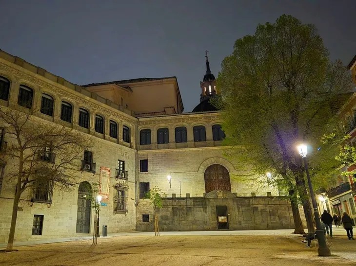
The Plaza de la Paja is located in the barrio or neighborhood of the Austrias, in the historic center of Madrid, and within the traditional district of La Latina. It is crossed from north to south by the Costanilla de San Andrés, close to Calle de Segovia , and different medieval roads converge here such as the Calle del Príncipe de Anglona and Calle Alamillo, Calle del Toro, Calle Alfonso VI and Calle de la Redondilla. The square takes its name from the obligation of the town’s residents to deliver straw (paja) to the chaplains and chapter of the Bishop’s Chapel for their mules. The best as narrow and one way streets with my car was a challenge is to take metro line 5 to La Latina stop. Or best take the bus, see more above ground on the EMT lines 3, 31, 50, 65 and 148 all have stops in the streets near the Plaza de la Paja. The Plaza de la Paja square was the great market during the 13-14C, and its true nerve center and agora. It fell into decline in the 15C, when King John II of Castile ordered the construction of the Plaza del Arrabal (the predecessor of the Plaza Mayor), to which the city’s commercial activity shifted. At the beginning of the 21C, this space was urbanized with a compacted earth park with a few trees arranged in quadrants and delimited by granite curbs, a combination that overcomes the uneven terrain. A few years earlier, the square was decorated with a bronze sculpture, following the fashion for life-size street figures, depicting a man reading a newspaper sitting on a stone bench attached to the façade of the Vargas Palace. Despite this, it maintained its importance as a residence for Madrid’s main noble families. In its surroundings were located different palaces, such as the palatial houses of the Lasso de Castilla and the Marquises of la Romana, among others, of which only the Vargas palace remains. The Bishop’s chapel appears attached to the parish complex of the Church of San Andrés (see post), although without direct access to it. It was built between 1520 and 1535, at the request of the House of Vargas, to house the mortal remains of San Isidro, who, in the 12C, was under the servitude of this family. Next to the chapel, on the eastern side of the enclosure, stands the Vargas Palace, from the 16C, but whose façade was transformed in the 20C, adopting a historicist solution and as an extension of the Bishop’s chapel, so that both complexes have the same façade. To the north of the square, the Prince of Anglona Garden is preserved, one of the few examples of 18C noble gardens in Madrid. Next to it, although now outside the Plaza de la Paja, stands the Prince of Anglona Palace, 16C. On Calle Redondilla , bottom of the square to the left,there is maybe the oldest standing building in Madrid at No 10 ; it’s from the 15C but remains from the Bronze Age have been discovered in this area.
The Madrid tourist office on the barrio or neighborhood of Austrias : https://www.esmadrid.com/en/madrid-neighbourhoods/austrias
The Madrid tourist office : https://www.esmadrid.com/en
There you go folks , another wonderful nostalgic, sentimental trip to my dear Spain, A love affairs with my Madrid, as do not know when we will be back, we sure will have it in our hearts foever Again, hope you enjoy this post on the streets of Madrid, part V !!! as I
And remember, happy travels, good health, and many cheers to all !!!


