
I am taking you back to America, as in Mexico. I have been there several times and sometimes even gone high , yes really high with great views of the city. These are some of the nostalgic streets of the City which have walked and drove on them but this time will show them with a new look, Therefore, this is my take on the streets of Mexico City with a twist !!! Hope you enjoy the post as I
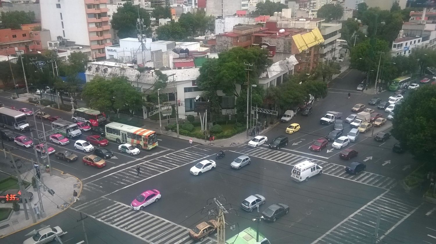
Metro Eje Central is a station on Line 12 of the Mexico City Metro. The station is located at the intersection between Eje Central (Lazaro Cardenas) and Avenida Popocatepetl. It is built underground. Right next to Plaza Universidad shopping center, in fact the hotel is connected to it inside. The Avenida Popocatepetl is name after the famous volcano.. The Jewel, in the famous Paso de Cortés which connects the Popocatépetl and Iztaccíhuatl volcanoes, from where the conquistador Hernán Cortés and his men saw the Mexican Valley for the first time on the way to Tenochtitlán (today Mexico City). See it from above !
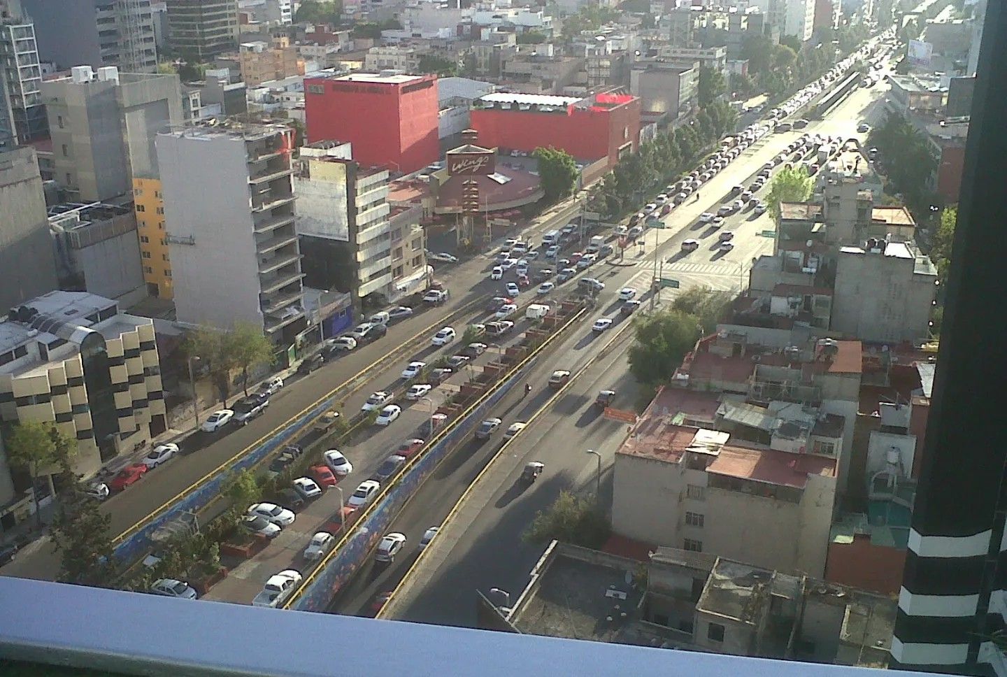
The Torre Mayor is a skyscraper located at no 505 of Paseo de la Reforma, The tower has a height of 225.meters from Paseo de la Reforma, and 55 floors, in addition to 4 levels of underground parking and 9 above street level, with more than 2,000 self-service spaces available. It is equipped with 29 elevators /lifts and 84,135 m² of office space, 2 pressurized emergency stairs, automatic air conditioning units, mechanical, electrical and telecommunications systems on each floor. The Torre Mayor is considered one of the strongest skyscrapers in the world and the one with the highest seismic tolerance in the world, with a maximum tolerance of 9.0 on the Richter scale. Likewise, it is considered the most solid and resistant tower on the planet, for its anti-seismic attachments and accessories. The Avenida Paseo de la Reforma is about 15 km long. The name commemorates a series of liberal reforms carried out during the presidency and by the government of Benito Juárez in the 19C. It was traced on the orders of Emperor Maximilian I of Mexico and was first called “Paseo de la Emperatriz” (promenade of the emperatrice). Inspired by the great European boulevards, it was intended to link the Chapultepec Castle to the National Palace located in the center of the city. It begins at Chapultepec Park, passes along the Torre Mayor and crosses the Zona Rosa and then to the Plaza de la Constitución (popular name is Zócalo) along Avenida Juárez and Calle Francisco I. Madero. See the picture from above the Torre Mayor!
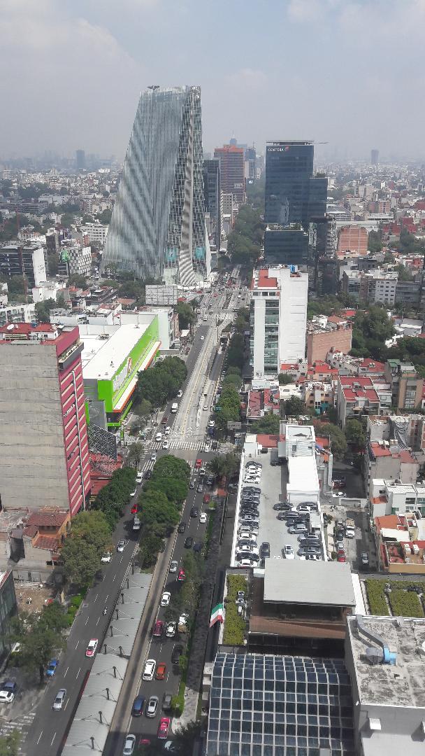
The Avenida de los Insurgentes is a group of three continuous avenues that form one of the main road axes of the west of Mexico City. It has a combined length of about 29 km through most of the Mexican capital. It is divided into three avenues or zones: the north (norte), the central zone(centro), the southern zone (Sur). See the pic from above, The one I visit the most is the Avenida de los Insurgentes Sur: This area begins at the crossroads with Paseo de la Reforma and, due to its extension, will be divided into several zones. These are briefly: Avenida de los Insurgentes Sur (Cuauhtémoc – Juárez). Avenida de los Insurgentes Sur (Roma). Avenida de los Insurgentes Sur (Napoles – Del Valle). Avenida de los Insurgentes Sur (Florida – Mixcoac). Avenida de los Insurgentes Sur (San Ángel). Avenida de los Insurgentes Sur (C.U. – Pedregal). Avenida de los Insurgentes Sur (Cuicuilco – Tlalpan). Here are some interesting places to visit including the one I go to the World Trade Center. The Galerias Insurgentes shopping center, Plaza Manacar shopping center (both great) ,and the Teatro de los Insurgentes (wonderful) . The Torre Mural is a great shopping area too.
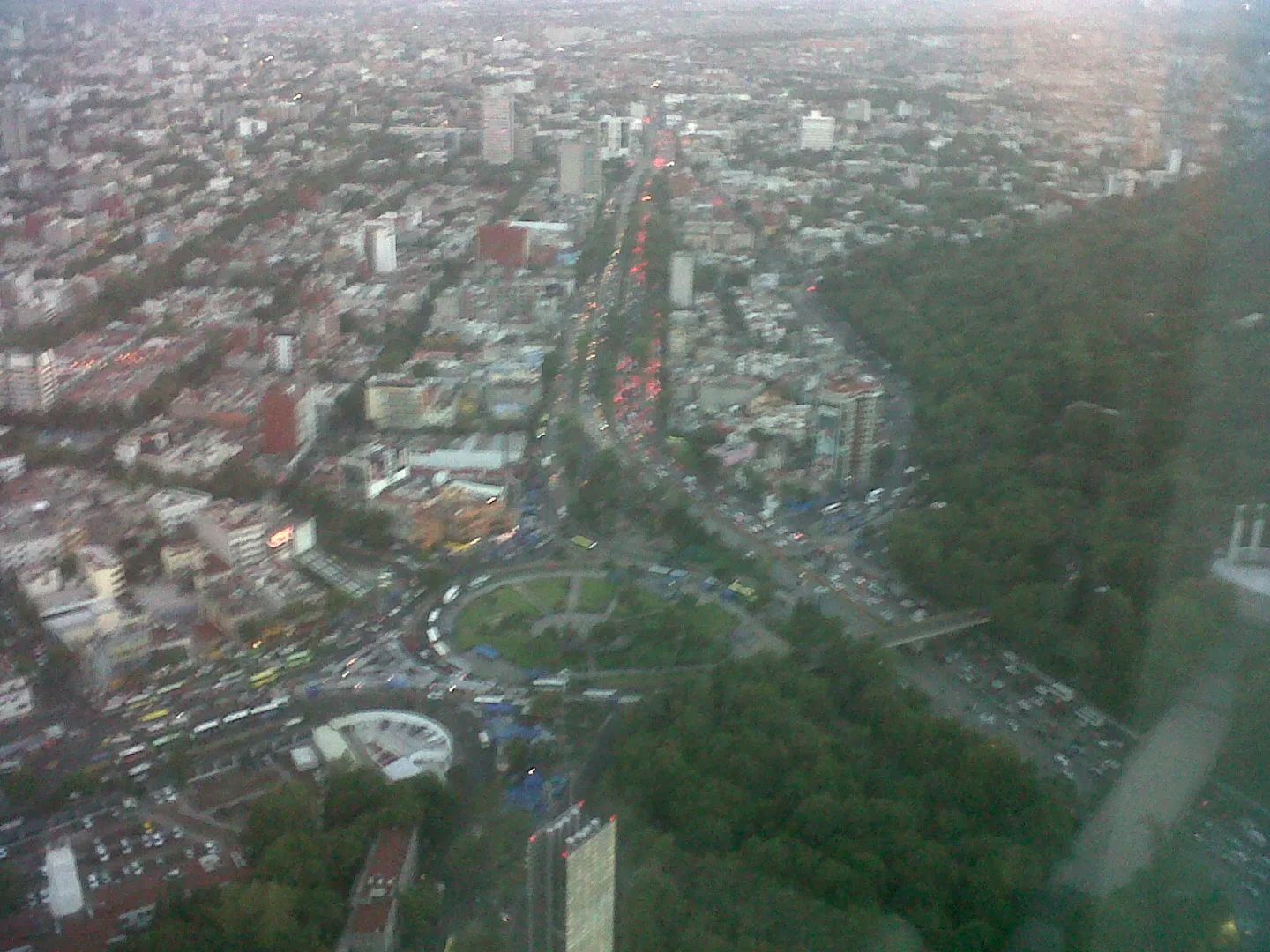
The Avenida de Chapultepec is one of the main roads of Mexico City located in the central and western part of it. It takes the vehicular route in both directions to communicate the central part of the city with the areas near the Bosque de Chapultepec, Tacubaya and Polanco districts. The name assigned to this avenue comes from the Nahuatl language Chapultepec, which in that language means “hill of crickets or grasshoppers”. Part of the layout of this avenue is due to the old Aqueduct of Chapultepec, an indigenous work that was built on the old lake of Texcoco to bring the waters of the springs of Chapultepec to the Aztec capital. The same route was taken towards the end of the 19c by the Imperial Committee of Emperor Maximilian I before the route of the so-called Paseo de la Emperatriz (the current Paseo de la Reforma).
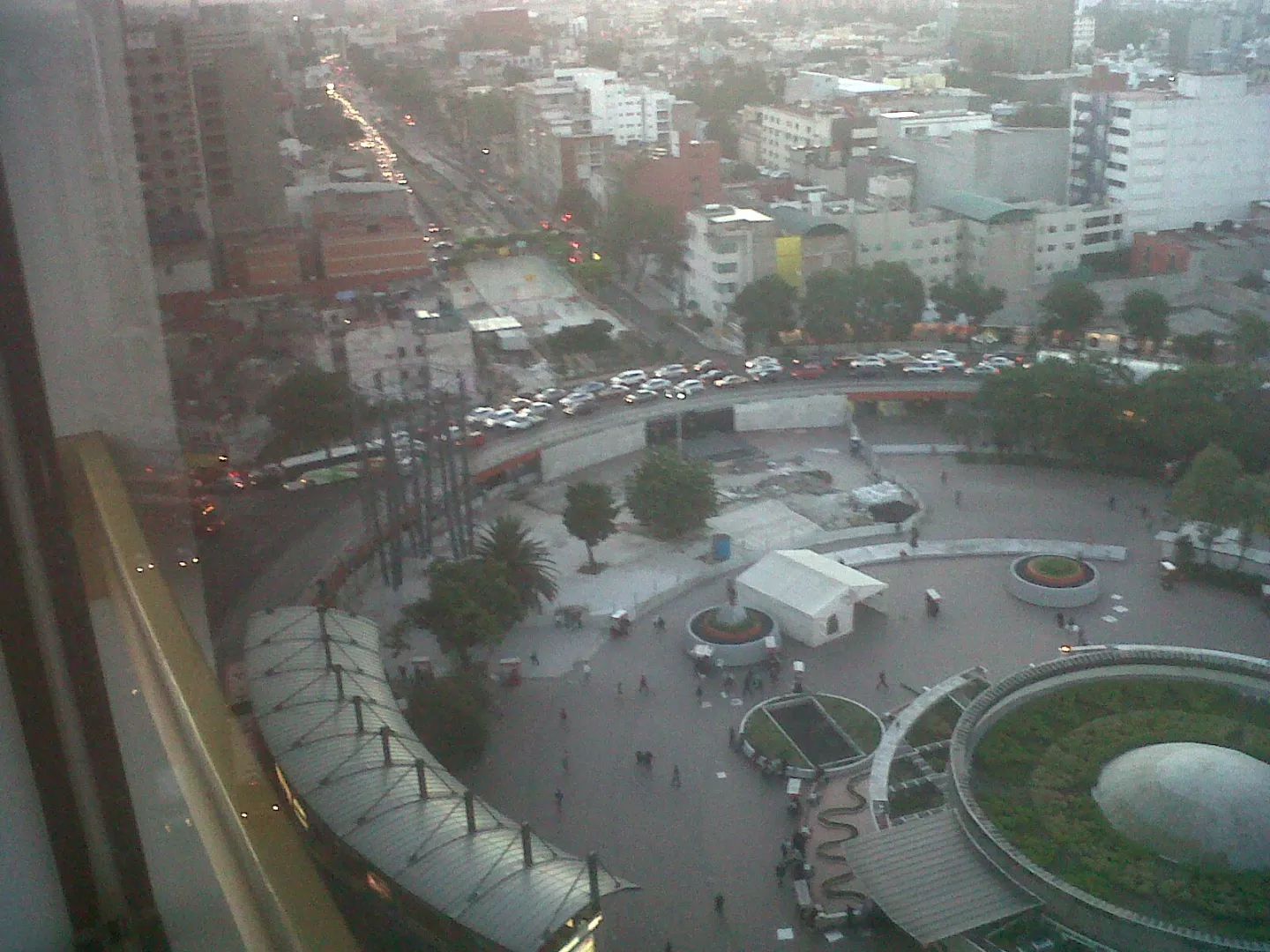
The idea was taken to conserve only 20 arcades of the old aqueduct located in the central ridge, near the Sevilla metro station. Likewise, the famous Glorieta de los Insurgentes beautiful roundabout (see picture) was designed and a replica of the fountain was placed where the aqueduct in front of the hermitage of Salto del Agua was concluded. Passing the roundabout we find the Zona Rosa on our right.My old hangout area when in Mexico from Florida !!! My bags loading was at the Hotel Royal Reforma in calle Amberes 78 almost corner with Avenida de Chapultepec from which the picture was taken!
The Mexico city tourist office: https://www.turismomexico.es/mexico-df-ciudad-de-mexico/
The Mexico National Tourist Office on Mexico City: https://visitmexico.com/en/estado/9/ciudad-de-mexico
There you go folks, a nice view of nice walking areas in Mexico city for all to enjoy and soak in the local culture. Not to leave great views of this huge city that you need to pinpoint the address very well to get to your location. Again, hope you enjoy this post on the streets of Mexico City with a twist !!! as I
And remember, happy travels, good health, and many cheers to all !!!
